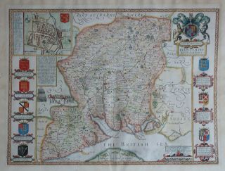
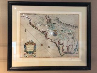
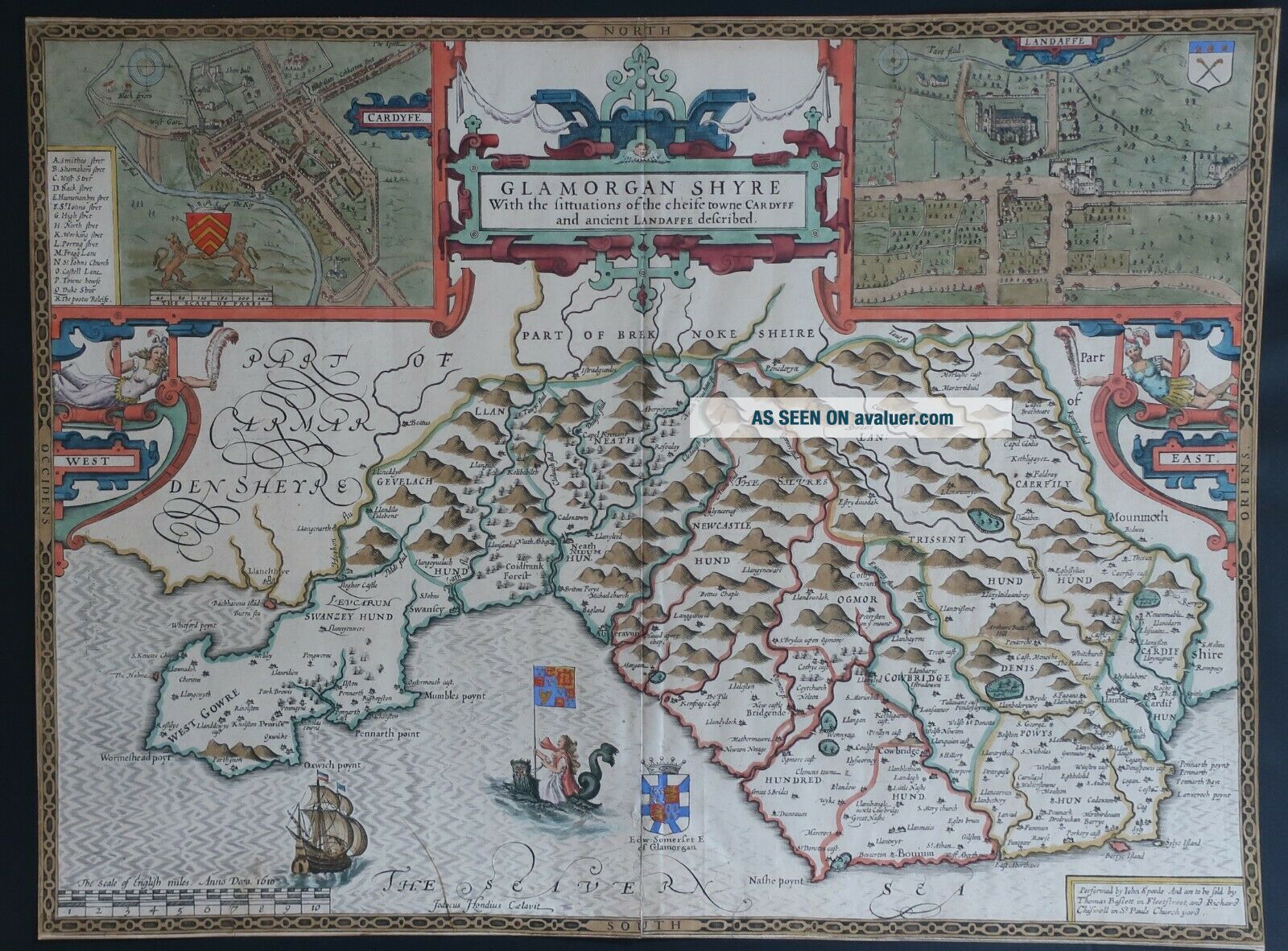
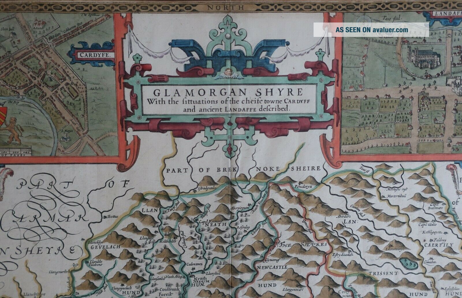
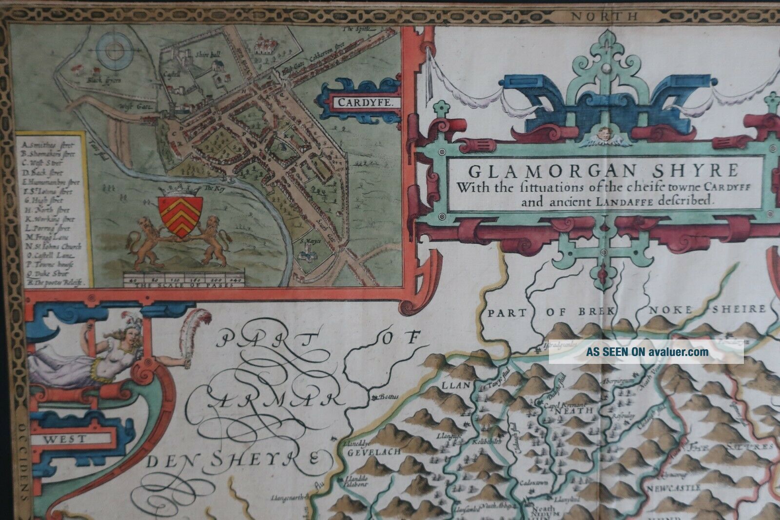
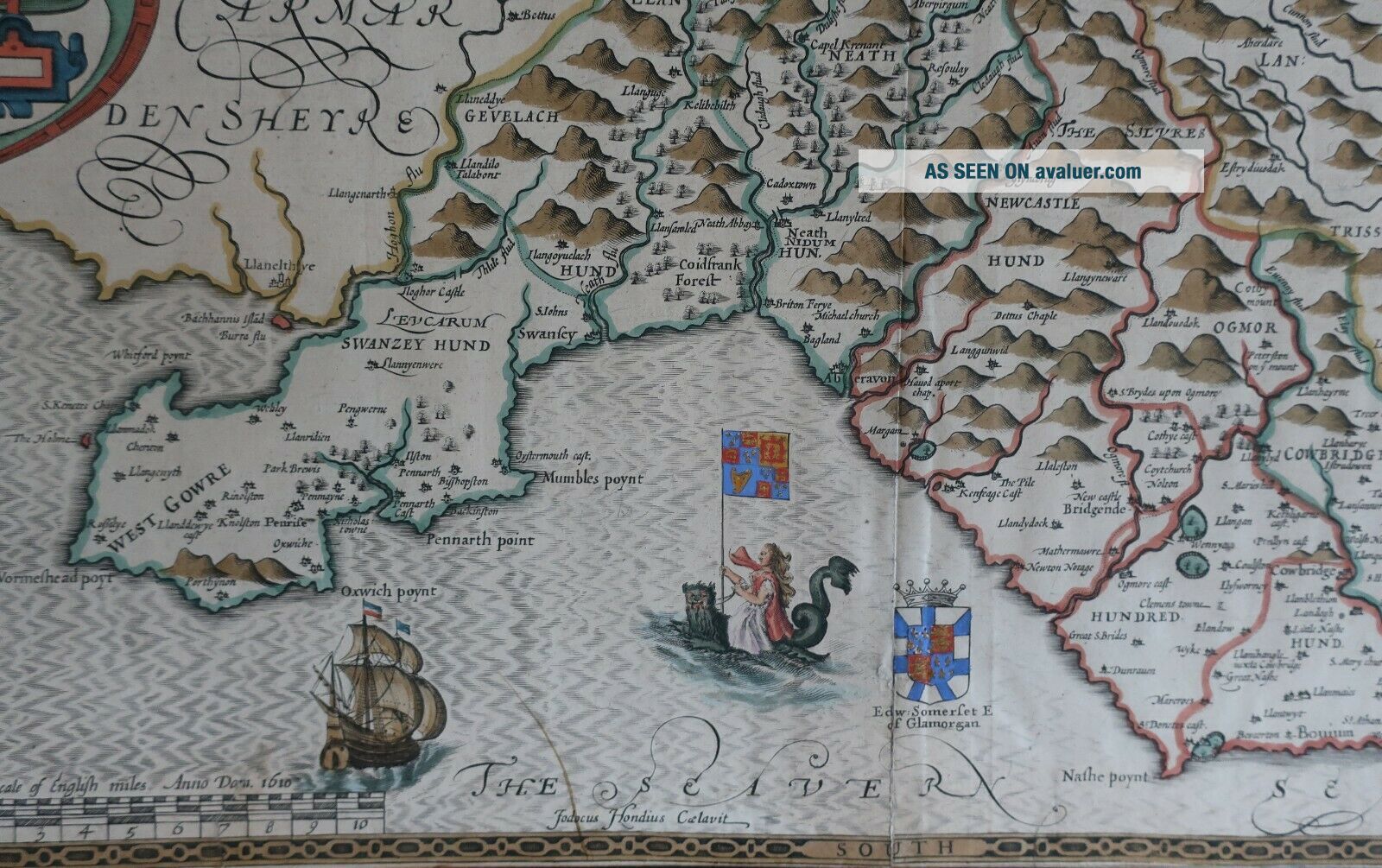
Early John Speed Map Of Glamorganshire, Wales, Hand Coloured Circa 1676

Item History & Price
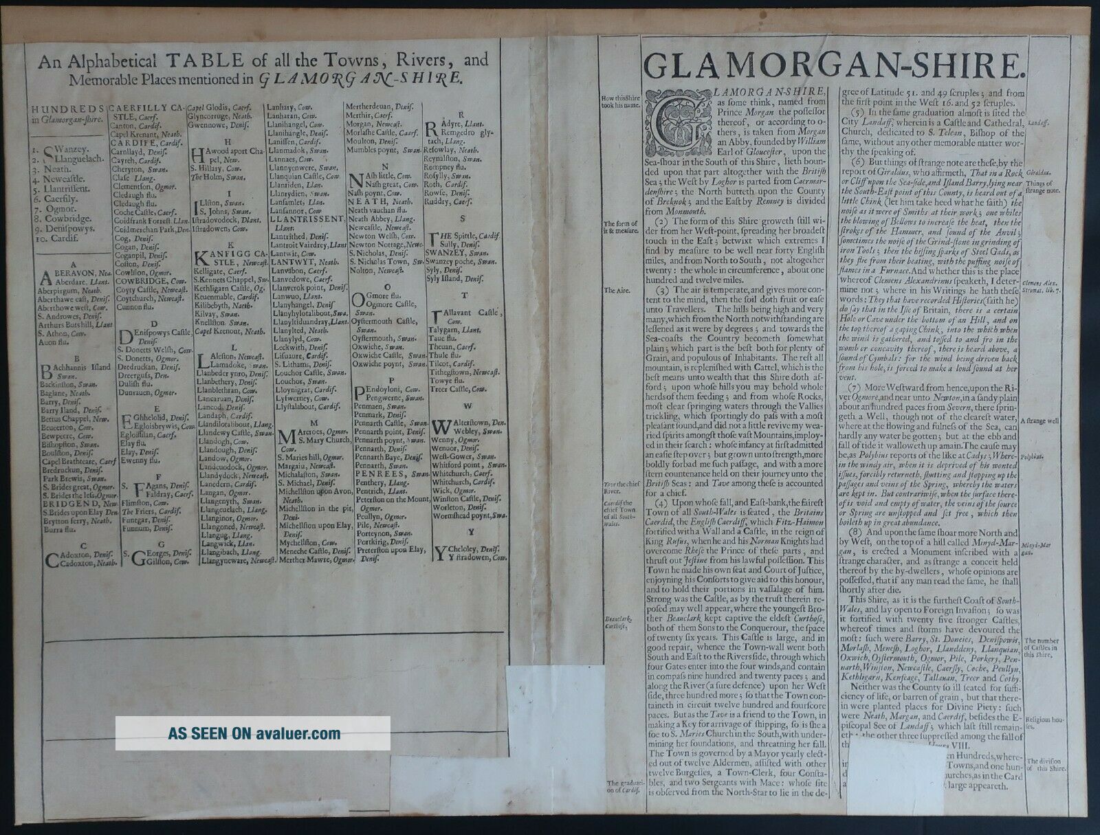
Description: Early copperplate engraved map of Glamorganshire, Wales by probably Great Britain's greatest mapmaker John Speed. Sold by Thomas Bassett and Richard Chiswell in London in 1676. Super map with original hand colouring. . Date/ age of item: 1676. Size: Size of engraved area 510mm x 380mm. Condition: The map, which has original hand colouring is close trimmed to the ornate border and has a light stain just right of the ship bottom... left. There is also a small repaired tear through the 7 on the scale of miles and a small repaired tear just below the text 'Nathe poynt, both barely visible. Also tape on the reverse along the bottom issued fold. Mounted and framed this map will look stunning. Combined Postage: We only charge postage on one item, this being either the largest or heaviest and on the understanding that all items are sent as one lot. This only applies to pictures that come unmounted. Where mounts are included within the picture price additional charges would need to be added for four or more lots in one transaction.Shipping: UK items are sent by Royal Mail Recorded delivery, second class, non-UK shipping is by either International Signed For delivery, International Tracked delivery or International Tracked and Signed For delivery depending on the country being shipped too. Royal Mail rules not ours.Combined Postage: Collection only.Payment: Sadly, because of the number of non-payers on Ebay, if payment is not made within seven days we will re-list the item and claim our selling fees back.