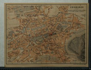
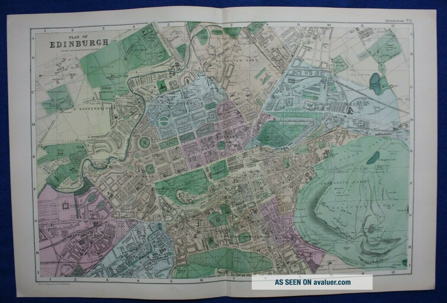
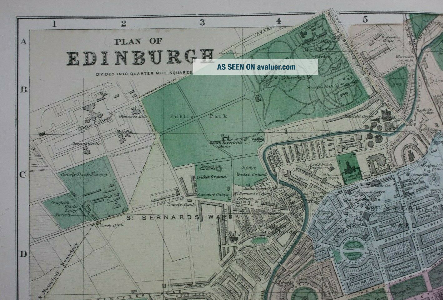
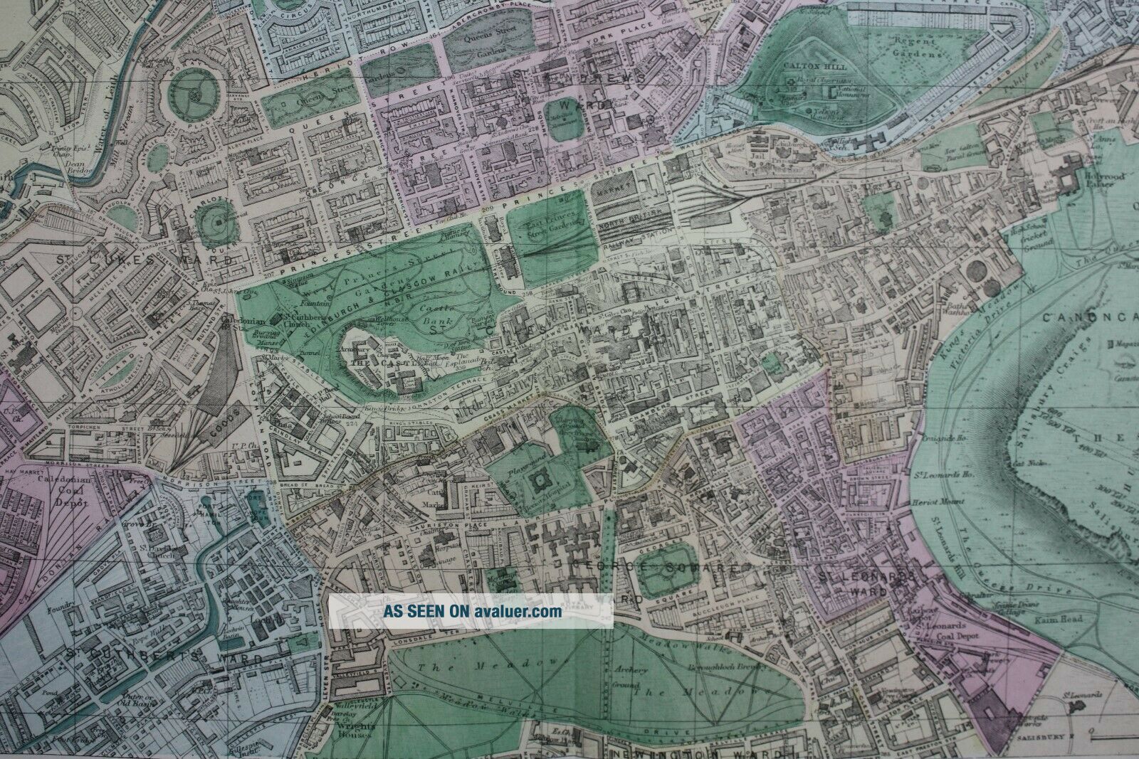
PLAN OF EDINBURGH, Scotland, Antique Atlas Map / City Plan, Bacon, 1895
Item History & Price
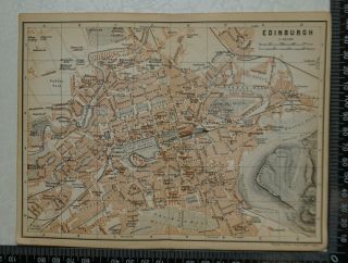
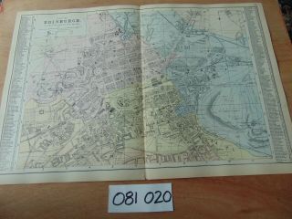
Title / Subject: 'Plan of Edinburgh'
Date: 1895
Size: The sheet measures approximately 530mm x 345mm
Description: An original, antique, hand-coloured map of Edinburgh divided into quarter mile square. It has significant detail of place names, roads, streets and railways.
Cartographer / Engraver: George W. Bacon
Provenance: 'Commercial and Library Atlas of the British Isles from the Ordnance Survey with Index - Gazeteer, Plans of Towns, Also Copious Letterpress Descriptio...ns, Tables of Population &c, Edited by G. W. Bacon FRGS', London, G. W. Bacon & Co., Limited, 127, Strand, 1895
Condition: Excellent condition. Centrefold as published. Light age toning. Please study all the photographs carefully to fully appreciate the condition.
Ref: #04024
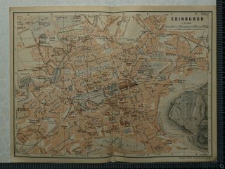