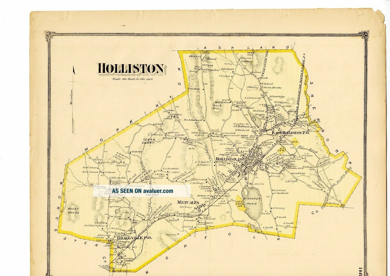
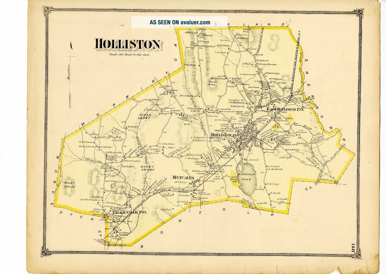
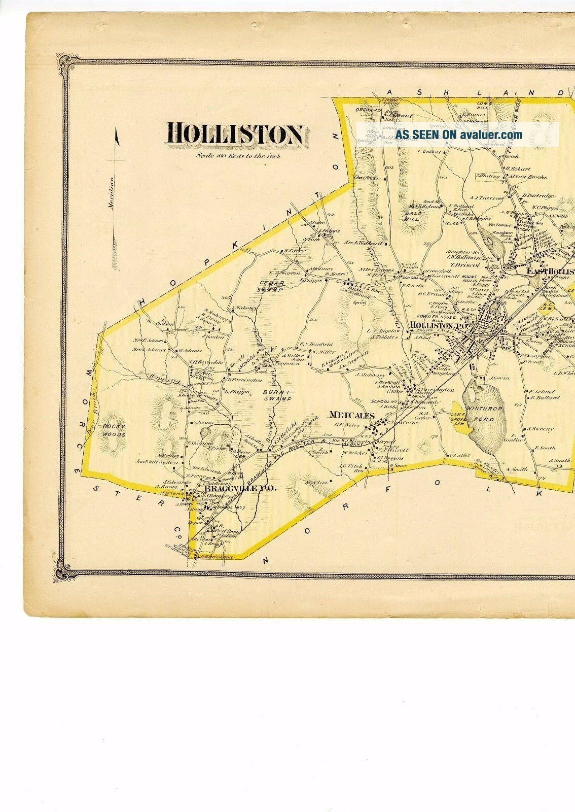
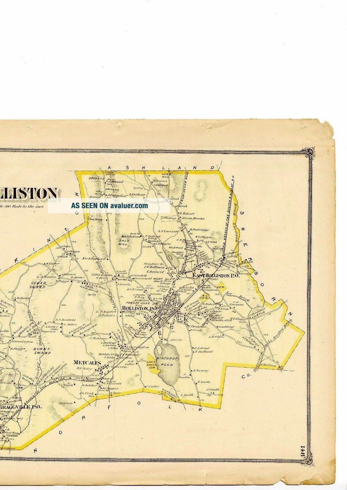
1875 Map Of Holliston, Mass. From Beers Atlas Of Middlesex County W/family Names


Item History & Price

Information:
Reference Number: Avaluer:1235599Type: Map
Publication Year: 1875Maker: F. W. Beers
Year: 1875Original/Reproduction: Original
Original Description:
Antique map of Holliston, Massachusetts, from the F.W. Beers' Atlas of Middlesex County, published in 1875. Plate 148. Hand colored. Approx. 14 by 16.5 inches. The town map shows the whole town of Holliston, with property owners' names on most houses outside of the central village. The town map also shows: Living Spring, Cemeteries, Long Hill, Bald Hill, Powder House Hill, Winthrop Pond, Schoolhouses, Saving Bank, Milford Branch of the Boston & Albany Railroad, Depot, Roc...ky Woods, Boggistere Brook, Dirty Meadow Brook, Cedar Swamp, Slaughter Houses, Mount Hollis, Boot Shop, Burnt Swamp, Hopping Brook, Town Hall, Ice House, Depot & P.O., Chicken Brook, etc.Approximately 16.5 inches by 14 inches. Hand colored. Condition: Margins are tattered but image area is fine. See scans.A great gift for anyone who is interested in the history and genealogy of Holliston!

00311


    Similar items


  • 1870 Map Of Monson,  Mass.  From Atlas Of Hampden County,  W/family Names -

    1870 Map Of Monson, Mass. From Atlas Of Hampden County, W/family Names -

  • 1870 Map Of Granville,  Mass.  From Atlas Of Hampden County,  With Family Names

    1870 Map Of Granville, Mass. From Atlas Of Hampden County, With Family Names

  • 1875 Map Of Ashland Ma From Beers

    1875 Map Of Ashland Ma From Beers ' Atlas Of Middlesex County With Family Names

  • 1875 Map Of Cabot,  Vermont From Atlas Of Caledonia County W/family Names

    1875 Map Of Cabot, Vermont From Atlas Of Caledonia County W/family Names

  • 1870 Map Of Wilbraham,  Mass.  From Atlas Of Hampden County W/family Names

    1870 Map Of Wilbraham, Mass. From Atlas Of Hampden County W/family Names

  • Rare 1875 Map Of Lyndon,  Vermont From Atlas Of Caledonia County W/family Names

    Rare 1875 Map Of Lyndon, Vermont From Atlas Of Caledonia County W/family Names

  • Old Map Of Westfield,  Ma From 1875 - Vintage Massachusetts Art,  Historic Decor

    Old Map Of Westfield, Ma From 1875 - Vintage Massachusetts Art, Historic Decor

  • 1875 Map Of Dracut & Shirley,  Ma.  Removed From The Beer

    1875 Map Of Dracut & Shirley, Ma. Removed From The Beer ' S Atlas


    • You might also like


    • 1860 Mitchell Hand Colored Map Colorado,  Nebraska & Kansas - Civil War Era

      1860 Mitchell Hand Colored Map Colorado, Nebraska & Kansas - Civil War Era

    • 18th Century French Map Of North America

      18th Century French Map Of North America

    • Las Vegas Nevada Vintage 1967 Us Geological Survey Quadrangle Map 4 Panels

      Las Vegas Nevada Vintage 1967 Us Geological Survey Quadrangle Map 4 Panels

    • Rare Antique 1845 Maps United States Exploring Expedition Book Antartica Hawaii

      Rare Antique 1845 Maps United States Exploring Expedition Book Antartica Hawaii

    • Vintage 1926 Map Hollywood From The Best Surveys Of The Time

      Vintage 1926 Map Hollywood From The Best Surveys Of The Time

    • American Continent (western Hemisphere) 1747 Bowen Antique Copper Engraved Map

      American Continent (western Hemisphere) 1747 Bowen Antique Copper Engraved Map

    • Gulf Coast Florida Texas United States 1705 De Fer Unusual Antique Engraved Map

      Gulf Coast Florida Texas United States 1705 De Fer Unusual Antique Engraved Map

    • California As Island United States 1700 De Fer Unusual First Edition Antique Map

      California As Island United States 1700 De Fer Unusual First Edition Antique Map

Avaluer          About Us          Privacy Policy          Contact Us          UP
© 2022, avaluer.net, Inc. or its affiliates