1860 Atlas Map Of Nova Scotia & Brunswick Hand Colored 15” X 12”


Item History & Price

Information:
Reference Number: Avaluer:1242335Original/Reproduction: Antique Original
Date Range: 1860 (dated)Canadian Province: New Brunswick, Nova Scotia, Prince Edward Island
City: HalifaxType: World Atlas
Country/Region: CanadaYear: 1860
Original Description:
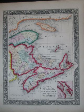
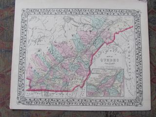
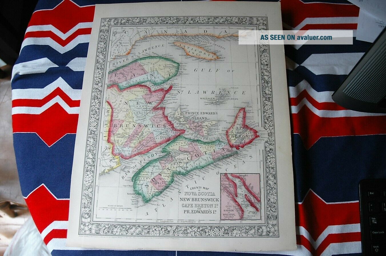
A Beautiful large Original Antique Map from Mitchell's Atlas
Published by S. Augustus Mitchell Jr. in the year 1860. 

This is an original hand painted map, it is not a reproduction or copy. Condition is Fine and above average for 159 years old. Would look terrific framed.

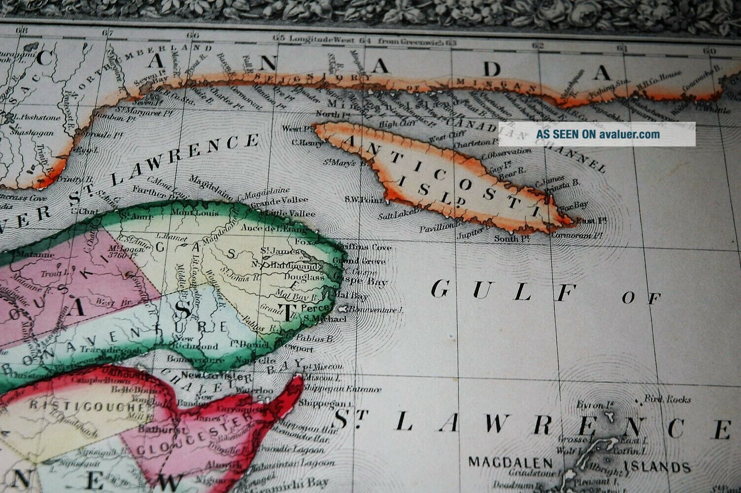
This map is of  Nova Scotia , New Brunswick, Prince Edwards Island, Cape Breton Island, Gulf & River of St Lawrence, Anticosti Island. These lands and waters border The U.S. State of ...Maine, and Canada as shown.

Dimensions approximately: 15” x 12”

This map is dated on the bottom 1860 in the Copyright area as entered according to Act of Congress in the District Court of Pennsylvania
Hand colored
Buyer to pay $3.95 for shipping and handling within the USA


    Similar items


  • 1860 Mitchell Map Of Nova Scotia,  Brunswick,  Canada Antique

    1860 Mitchell Map Of Nova Scotia, Brunswick, Canada Antique

  • 1885 Map Of The District Of Alaska - Map Of Nova Scotia & Brunswick On Back

    1885 Map Of The District Of Alaska - Map Of Nova Scotia & Brunswick On Back

  • Map Of The District Of Alaska - Map Of Nova Scotia & Brunswick On Back 1885

    Map Of The District Of Alaska - Map Of Nova Scotia & Brunswick On Back 1885

  • 1883 Blackie Map - Canada - Nova Scotia Brunswick Newfoundland Halifax Fundy

    1883 Blackie Map - Canada - Nova Scotia Brunswick Newfoundland Halifax Fundy

  • Vintage 1872 Mitchell Hand Colored Map Of Nova Scotia & Quebec.

    Vintage 1872 Mitchell Hand Colored Map Of Nova Scotia & Quebec.

  • Postal History Of Nova Scotia & Brunswick 1964 Hardcover 343 Of 400

    Postal History Of Nova Scotia & Brunswick 1964 Hardcover 343 Of 400

  • Estate Crown Warwick Porcelain Shell Dish W/map Of Nova Scotia And Tartan

    Estate Crown Warwick Porcelain Shell Dish W/map Of Nova Scotia And Tartan

  • Old Vintage Postcard Map Of Nova Scotia Canada Engraved By J Bartholomew Halifax

    Old Vintage Postcard Map Of Nova Scotia Canada Engraved By J Bartholomew Halifax


    • You might also like


    • 1860 Mitchell Hand Colored Map Colorado,  Nebraska & Kansas - Civil War Era

      1860 Mitchell Hand Colored Map Colorado, Nebraska & Kansas - Civil War Era

    • 18th Century French Map Of North America

      18th Century French Map Of North America

    • Las Vegas Nevada Vintage 1967 Us Geological Survey Quadrangle Map 4 Panels

      Las Vegas Nevada Vintage 1967 Us Geological Survey Quadrangle Map 4 Panels

    • Rare Antique 1845 Maps United States Exploring Expedition Book Antartica Hawaii

      Rare Antique 1845 Maps United States Exploring Expedition Book Antartica Hawaii

    • Vintage 1926 Map Hollywood From The Best Surveys Of The Time

      Vintage 1926 Map Hollywood From The Best Surveys Of The Time

    • American Continent (western Hemisphere) 1747 Bowen Antique Copper Engraved Map

      American Continent (western Hemisphere) 1747 Bowen Antique Copper Engraved Map

    • Gulf Coast Florida Texas United States 1705 De Fer Unusual Antique Engraved Map

      Gulf Coast Florida Texas United States 1705 De Fer Unusual Antique Engraved Map

    • California As Island United States 1700 De Fer Unusual First Edition Antique Map

      California As Island United States 1700 De Fer Unusual First Edition Antique Map

Avaluer          About Us          Privacy Policy          Contact Us          UP
© 2022, avaluer.net, Inc. or its affiliates