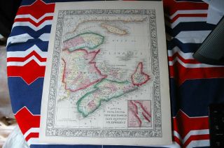
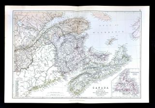
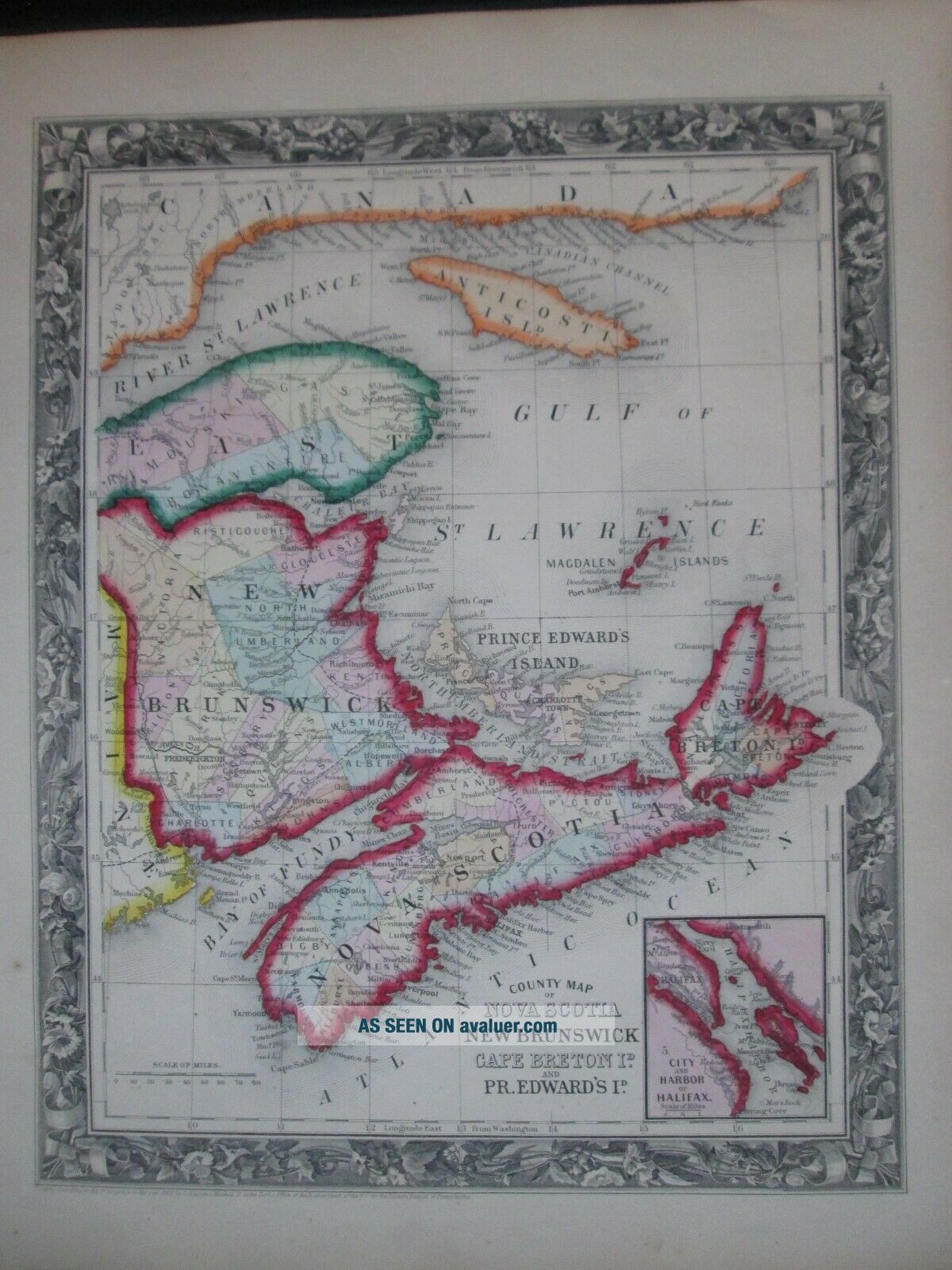
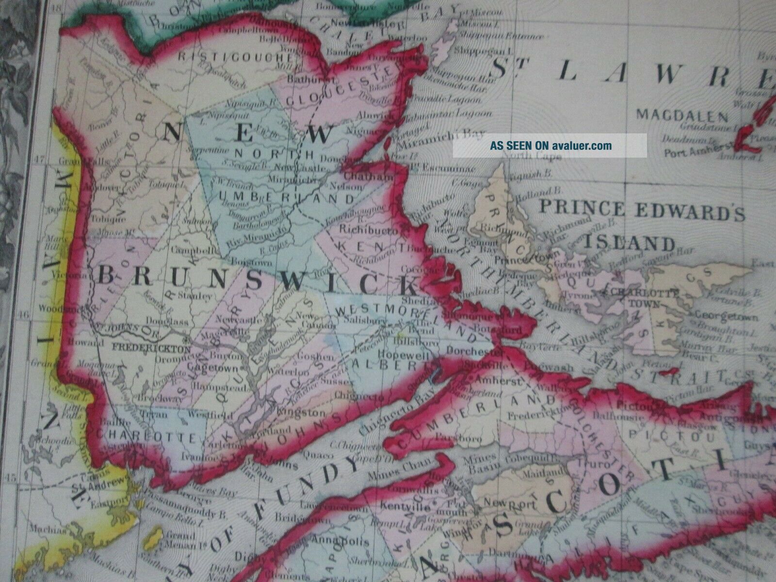
1860 Mitchell Map Of Nova Scotia, Brunswick, Canada Antique


Item History & Price

Information:
Reference Number: Avaluer:48272123
Original Description:
1860 Mitchell map of Nova Scotia, New Brunswick, Canada * Original Antique!
This is an antique map with original hand coloring.
Size is 15.5" x 12.5" or 39.5cm x 31.75cm
Condition is Very Good 
From 1860 Mitchell's New General Atlas (first edition)Published by S. Augustus Mitchell, Jr.No. 31 South Sixth Street, Philadelphia
Please view my ebay store for more quality items!


    Similar items


  • 1860 Atlas Map Of Nova Scotia & Brunswick Hand Colored 15” X 12”

    1860 Atlas Map Of Nova Scotia & Brunswick Hand Colored 15” X 12”

  • 1885 Map Of The District Of Alaska - Map Of Nova Scotia & Brunswick On Back

    1885 Map Of The District Of Alaska - Map Of Nova Scotia & Brunswick On Back

  • Map Of The District Of Alaska - Map Of Nova Scotia & Brunswick On Back 1885

    Map Of The District Of Alaska - Map Of Nova Scotia & Brunswick On Back 1885

  • Vintage 1872 Mitchell Hand Colored Map Of Nova Scotia & Quebec.

    Vintage 1872 Mitchell Hand Colored Map Of Nova Scotia & Quebec.

  • 1860 Mitchell Map Of Boston,  Massachusetts

    1860 Mitchell Map Of Boston, Massachusetts

  • 1883 Blackie Map - Canada - Nova Scotia Brunswick Newfoundland Halifax Fundy

    1883 Blackie Map - Canada - Nova Scotia Brunswick Newfoundland Halifax Fundy

  • Postal History Of Nova Scotia & Brunswick 1964 Hardcover 343 Of 400

    Postal History Of Nova Scotia & Brunswick 1964 Hardcover 343 Of 400

  • Estate Crown Warwick Porcelain Shell Dish W/map Of Nova Scotia And Tartan

    Estate Crown Warwick Porcelain Shell Dish W/map Of Nova Scotia And Tartan


    • You might also like


    • 1860 Mitchell Hand Colored Map Colorado,  Nebraska & Kansas - Civil War Era

      1860 Mitchell Hand Colored Map Colorado, Nebraska & Kansas - Civil War Era

    • 18th Century French Map Of North America

      18th Century French Map Of North America

    • Las Vegas Nevada Vintage 1967 Us Geological Survey Quadrangle Map 4 Panels

      Las Vegas Nevada Vintage 1967 Us Geological Survey Quadrangle Map 4 Panels

    • Rare Antique 1845 Maps United States Exploring Expedition Book Antartica Hawaii

      Rare Antique 1845 Maps United States Exploring Expedition Book Antartica Hawaii

    • Vintage 1926 Map Hollywood From The Best Surveys Of The Time

      Vintage 1926 Map Hollywood From The Best Surveys Of The Time

    • American Continent (western Hemisphere) 1747 Bowen Antique Copper Engraved Map

      American Continent (western Hemisphere) 1747 Bowen Antique Copper Engraved Map

    • Gulf Coast Florida Texas United States 1705 De Fer Unusual Antique Engraved Map

      Gulf Coast Florida Texas United States 1705 De Fer Unusual Antique Engraved Map

    • California As Island United States 1700 De Fer Unusual First Edition Antique Map

      California As Island United States 1700 De Fer Unusual First Edition Antique Map

Avaluer          About Us          Privacy Policy          Contact Us          UP
© 2022, avaluer.net, Inc. or its affiliates