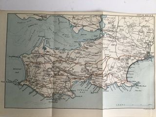
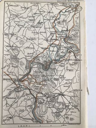
1888 ANTIQUE WALES MAP CHESTER & HOLDHEAD SHREWSBURY RAILWAYS ANGELSEA


Item History & Price

Information:
Reference Number: Avaluer:13549
Original Description:
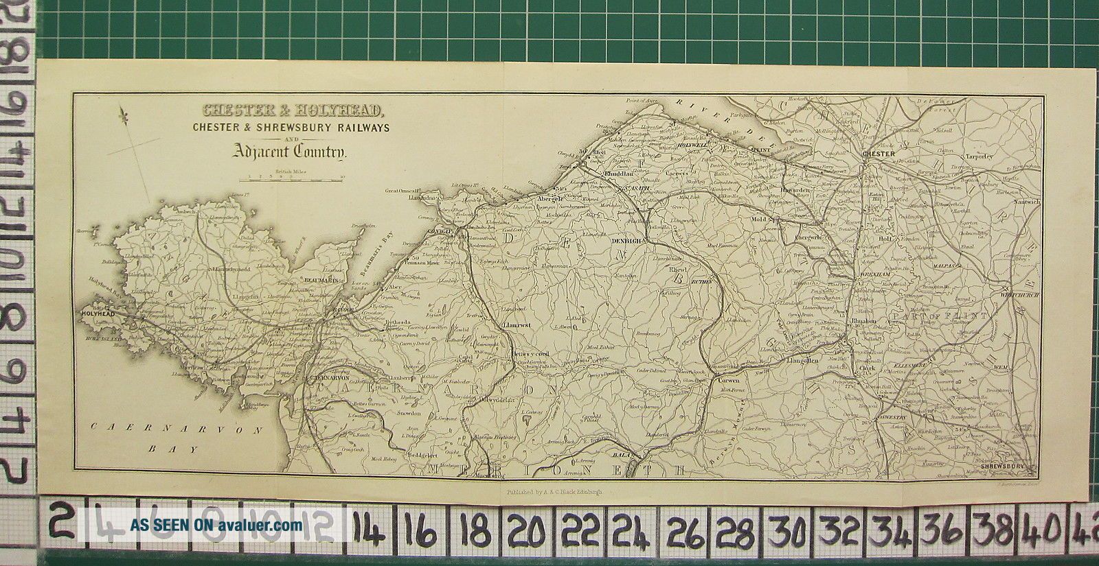
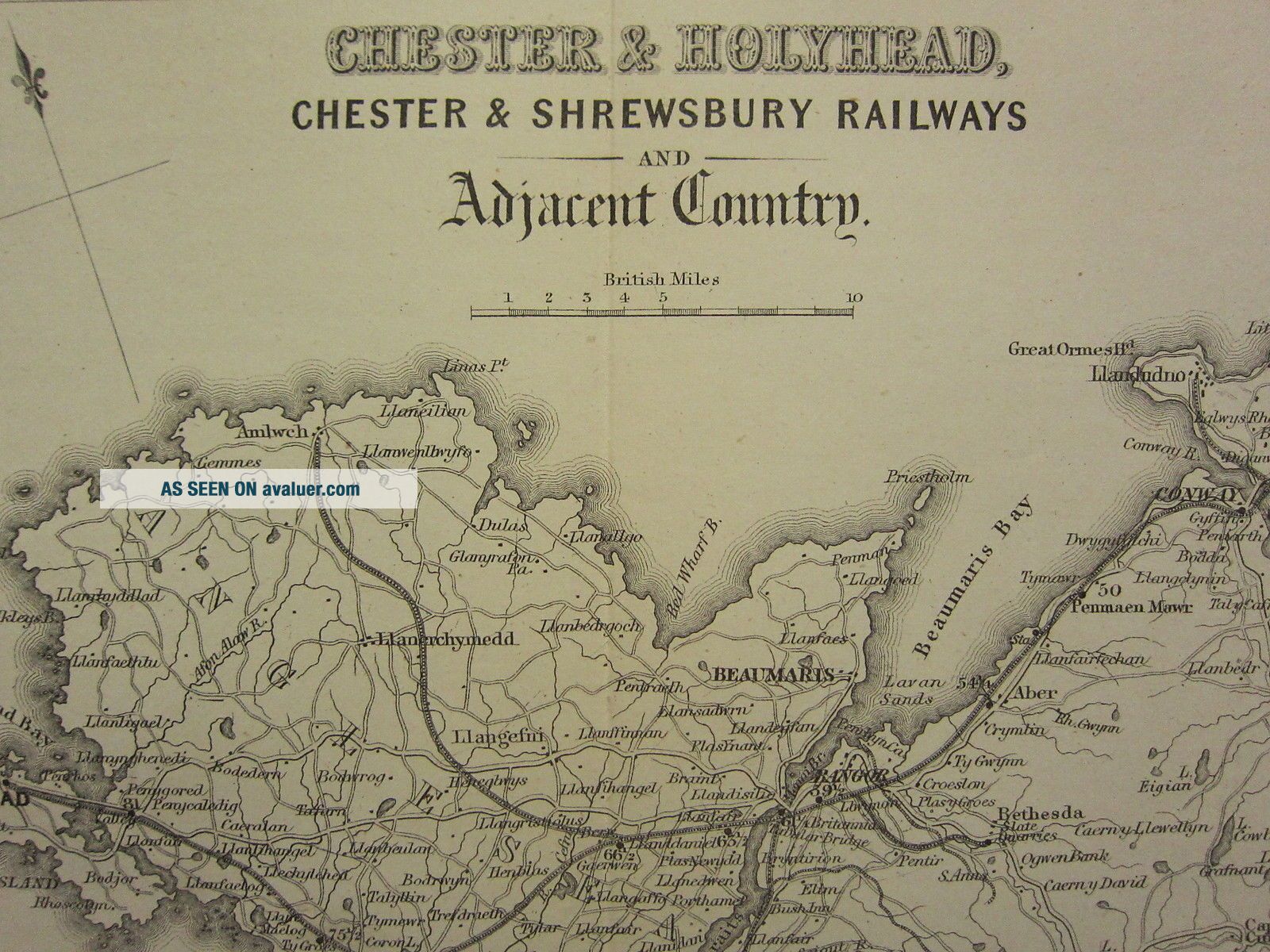
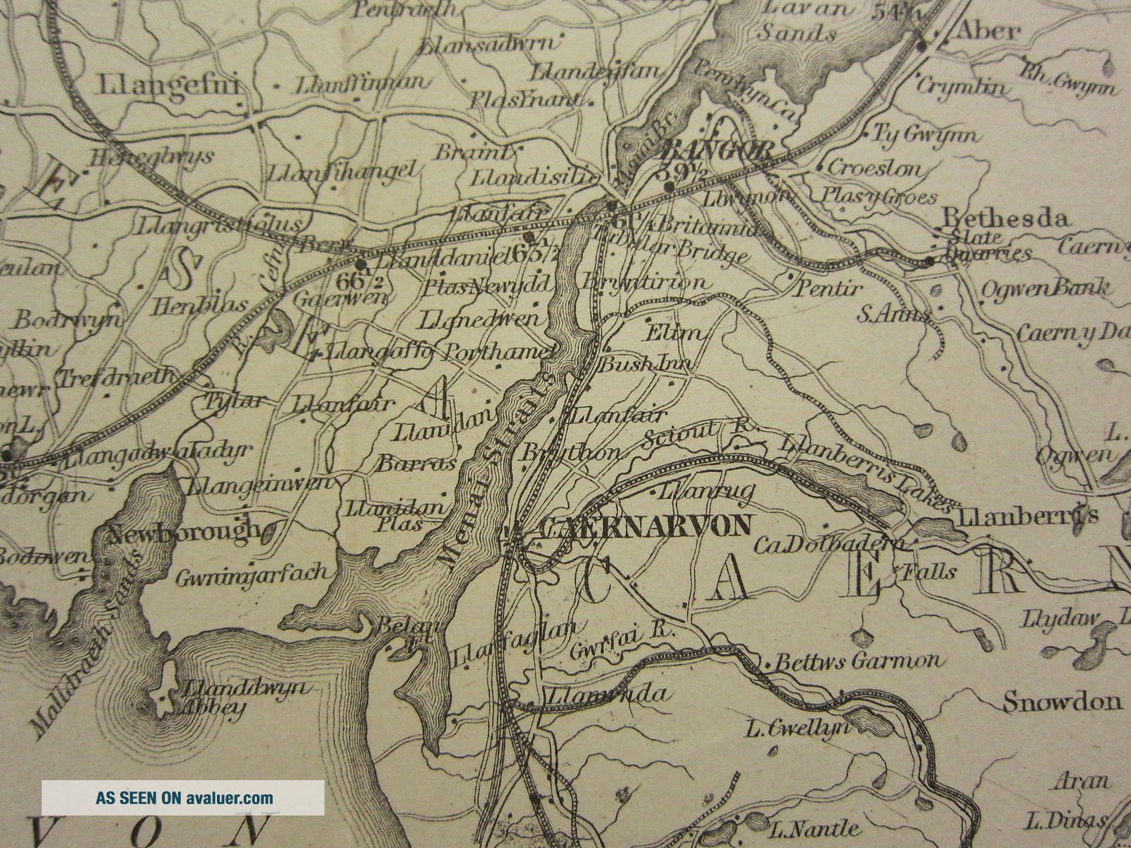
AN ORIGINAL ANTIQUE MAP OVER 125 YEARS OLDThis map is from a series produced for
Black's Picturesque Guide to Wales
1888THIS LISTING IS FOR THE SINGLE MAP SHOWN
 
To find the approximate size of this map
please check against the 2cm scale shown ****CONDITION****
PLEASE VIEW IMAGES TO SEE ANY HANDLING/AGE MARKS
/REPAIRS/DAMAGE/EXTENT OF MARGINS etc
*********************Please message with any questions regarding this itemBEST O...FFERS PLEASE FOR A
QUICK SALE AT A FAIR PRICE
If you like the item, but do not like the price,
then make a realistic offer to us using the
MAKE OFFER BUTTONBlacks 1888 Wales
Powered by eBay Turbo Lister


    Similar items


  • 1888 Antique County Map Wales Bartholomew,  Swansea The Mumbles Gower

    1888 Antique County Map Wales Bartholomew, Swansea The Mumbles Gower

  • 1888 Antique County Map Wales Bartholomew,  Monmouth Ross River Wye

    1888 Antique County Map Wales Bartholomew, Monmouth Ross River Wye

  • 1888 Antique Geology Map Of Martha

    1888 Antique Geology Map Of Martha ' S Vineyard

  • 1888 Antique Wisconsin Map Rare Miniature Size Map Of Wisconsin State Map 6772

    1888 Antique Wisconsin Map Rare Miniature Size Map Of Wisconsin State Map 6772

  • 1888 Antique Caribbean Map Rare Miniature Collectible Map Of The Caribbean 4799

    1888 Antique Caribbean Map Rare Miniature Collectible Map Of The Caribbean 4799

  • 1888 Antique Wisconsin Map Rare Miniature Size Map Of Wisconsin State Map 6514

    1888 Antique Wisconsin Map Rare Miniature Size Map Of Wisconsin State Map 6514

  • 1888 Antique Colorado Map Miniature Vintage Map Of Colorado State Map 5799

    1888 Antique Colorado Map Miniature Vintage Map Of Colorado State Map 5799

  • 1888 Antique Italy Map Rare Miniature Vintage Map Of Italy Gallery Wall 6512

    1888 Antique Italy Map Rare Miniature Vintage Map Of Italy Gallery Wall 6512


    • You might also like


    • Hungary & Romania 1579 (1584) Ortelius Unusual Antique Copper Engraved Map

      Hungary & Romania 1579 (1584) Ortelius Unusual Antique Copper Engraved Map

    • Brussels Bruxelles Belfium 1777 De Ferraris & Dupuis Large Antique Map Sheet Xxi

      Brussels Bruxelles Belfium 1777 De Ferraris & Dupuis Large Antique Map Sheet Xxi

    • 1616 Atlas Map Of Iceland.

      1616 Atlas Map Of Iceland.

    • Kazan Russia 1767 Le Clerc/lespinasse Antique Copper Engraved City View

      Kazan Russia 1767 Le Clerc/lespinasse Antique Copper Engraved City View

    • 1899 Stanford,  Folding Map Of Norwich,  Norfolk,  Arthur Collins,  Jarrold & Sons,

      1899 Stanford, Folding Map Of Norwich, Norfolk, Arthur Collins, Jarrold & Sons,

    • 1948 Vintage Linen Colour Map Geological Survey Ten Mile Of Great Britain

      1948 Vintage Linen Colour Map Geological Survey Ten Mile Of Great Britain

    • 1944 Map Flying Bombs Sussex Ww2 Newspaper Military Kent Courier German V1 V2

      1944 Map Flying Bombs Sussex Ww2 Newspaper Military Kent Courier German V1 V2

    • Dated 1638 Vellum Map Of Icklesham Sussex Showing Land Uses Owners Etc

      Dated 1638 Vellum Map Of Icklesham Sussex Showing Land Uses Owners Etc

Avaluer          About Us          Privacy Policy          Contact Us          UP
© 2022, avaluer.net, Inc. or its affiliates