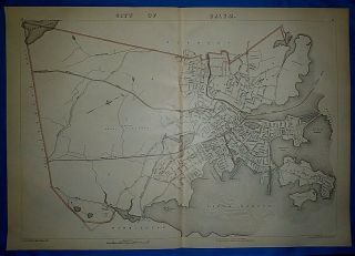
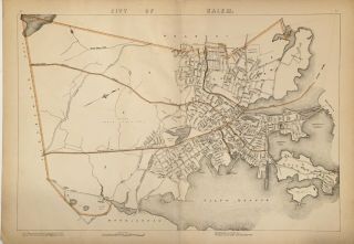
1891 Map City Of Salem Winter Island Salem Neck Kernwood Mass MA Old


Item History & Price
| Reference Number: Avaluer:15684139 | Year: 1891 |
| Topic: Atlases | Format: Atlas Map |
| Publication Year: 1891 | Type: City Map |
| Original/Reproduction: Original |
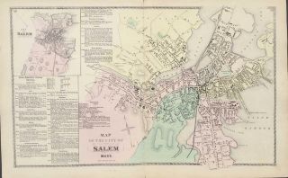
Original Map of the Metro areas of Boston Newton Waltham Brookline.It is from the Atlas of Massachusetts by Geo. H. Walker Publisher.
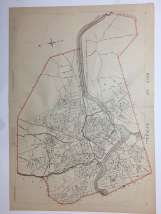
This is not a reproduction.Interesting map of the city of Salem also showing, Salem Neck, Winter Island, Beverly Harbor, Collins Cove, Beverly Harbor, Collin's cove, Salem Harbor, Mill Pond, St Peter' St Basin and Leggs Hill. Interesting map showing rivers, bodies of water, railways, roads, wards, schools, cemeteries, houses of worshi...p and numerous wharfs.The map is clean and in excellent condition with no folds as it was part of a rolled up Atlas. There are 4 round holes in the left margin where it was attached to the Atlas. These would not be visible when the map is framed.
There are a few minor edge tears to right margin (repaired) that would not be visible when framed.It measures 28" x 19.5". It will be shipped rolled up.Please see other maps in our Ebay store.
We have many more maps not listed - Please request any city or town.
00182