Antique Map John Speed 1610 Montgomeryshire 400 Years Old


Item History & Price

Information:
Reference Number: Avaluer:15707135County: Montgomeryshire
Year: 1610Cartographer/Publisher: John Speed
Date Range: 1600-1699Original/Reproduction: Antique Original
Country/Region: England, WalesType: County Map
Original Description:
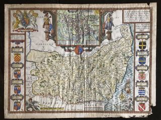
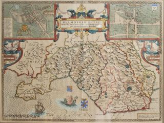
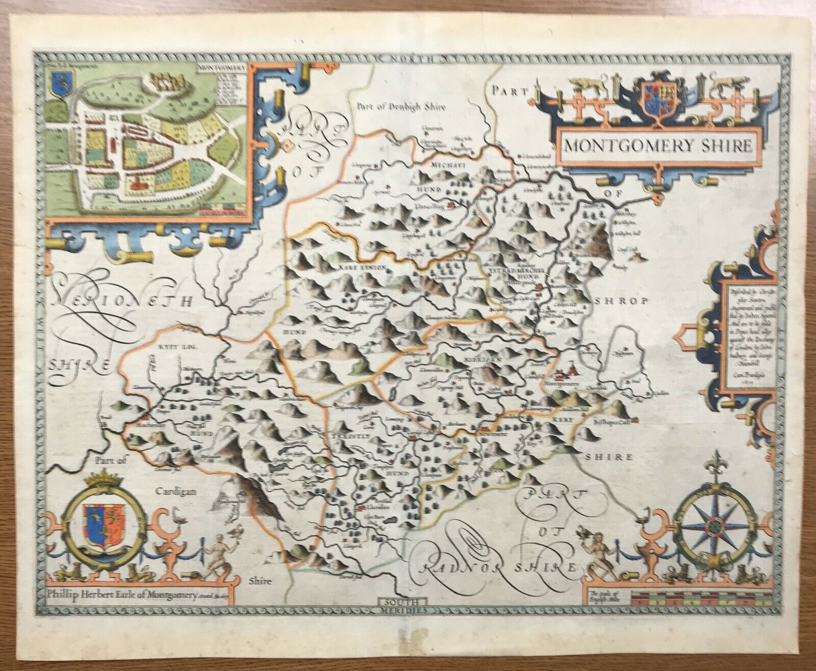
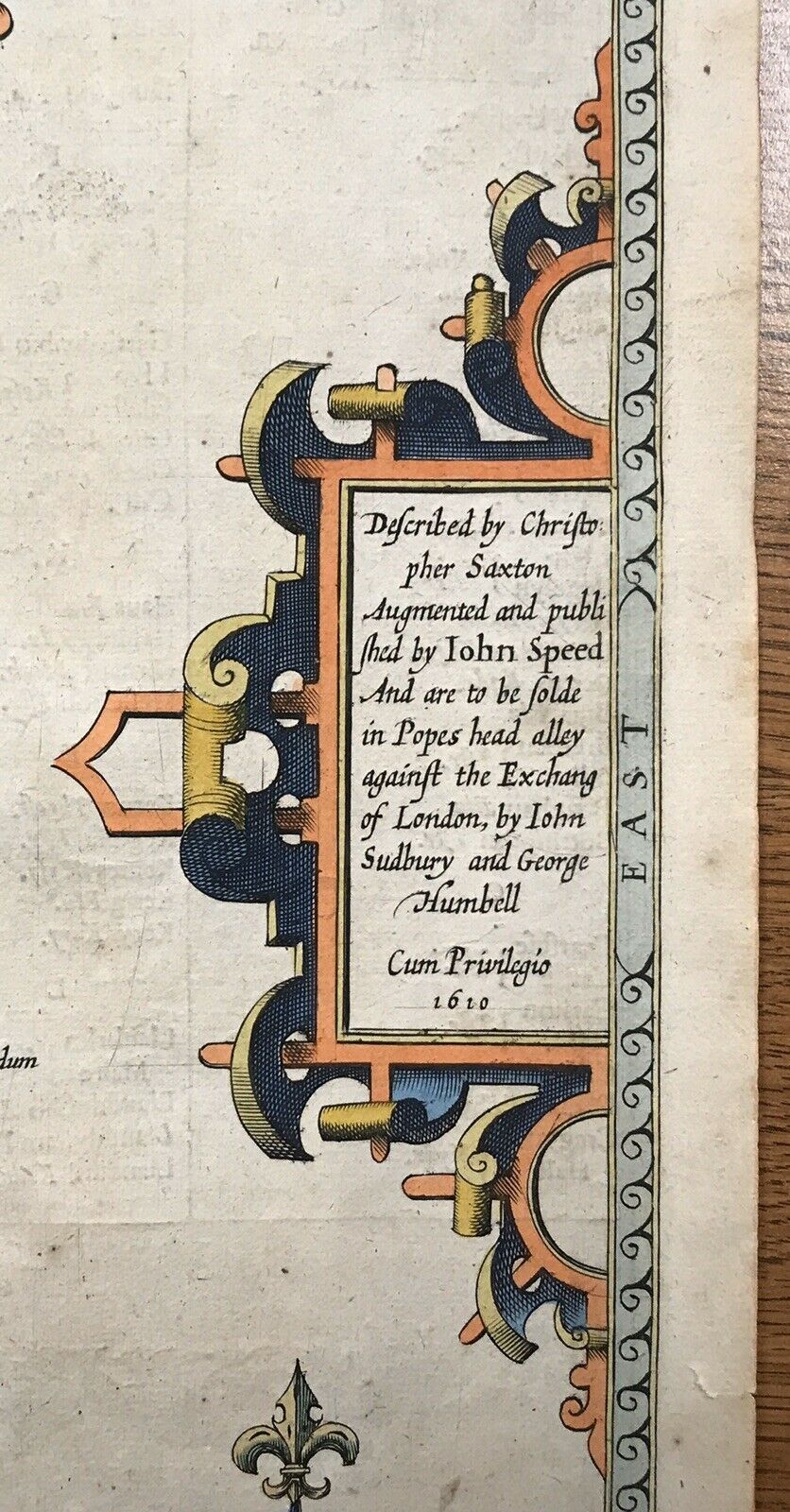
An excellent, hand-colored example of John Speed's county map of Montgomeryshire from his most important atlas, 'Theatre of the Empire of Great Britaine'.  Dated 1610.  A fine, dark impression with typesetting in English on the verso that matches the first edition published in 1611/1612.
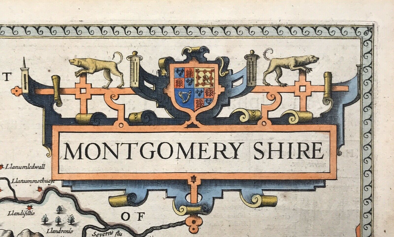
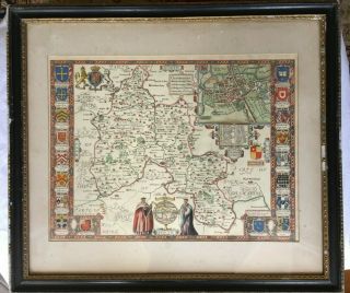
Beautiful strapwork cartouches with the coat of arms for the King of England in the upper right, a compass rose in the lower right and the coat of arms for Sir Philip Herbert, th...e first Earl of Montgomery (1605).  The inset in the upper left cornet is the town of Montgomery with a list of important sites.
On laid paper with nice period watermark.
The image size is 20 1/8" x 15 3/16" and full margins (sheet size 21.125" x 17.5")


    Similar items


  • Antique Map John Speede Suffolke Suffolk 1610

    Antique Map John Speede Suffolke Suffolk 1610

  • Framed British Isles Portrait Map,  John Speed 1610 - 12,  Gold Foil,  Vintage Retro

    Framed British Isles Portrait Map, John Speed 1610 - 12, Gold Foil, Vintage Retro

  • Antique Map John Speede (1552 - 1629) “oxfordshire / Oxford Colleges "

    Antique Map John Speede (1552 - 1629) “oxfordshire / Oxford Colleges "

  • Antique Map John Speede C1610 “cambridgeshire & Arms Of Princes "

    Antique Map John Speede C1610 “cambridgeshire & Arms Of Princes "

  • Antique Map John Speed 1627 Cantii,  Surriae,  Middlefexiae

    Antique Map John Speed 1627 Cantii, Surriae, Middlefexiae

  • Antique C17th John Speede Map,  Wales,  Cardiff,  Glamorganshire 1610,  Dual Aspect

    Antique C17th John Speede Map, Wales, Cardiff, Glamorganshire 1610, Dual Aspect

  • John Speed,  Antique Map Of Northamptonshire,  1610 Al 10 - 19a

    John Speed, Antique Map Of Northamptonshire, 1610 Al 10 - 19a

  • Antique Map Isle Of Man Thomas Durham 1595 John Speed 1610 Hand Colored Framed

    Antique Map Isle Of Man Thomas Durham 1595 John Speed 1610 Hand Colored Framed


    • You might also like


    • Hungary & Romania 1579 (1584) Ortelius Unusual Antique Copper Engraved Map

      Hungary & Romania 1579 (1584) Ortelius Unusual Antique Copper Engraved Map

    • Brussels Bruxelles Belfium 1777 De Ferraris & Dupuis Large Antique Map Sheet Xxi

      Brussels Bruxelles Belfium 1777 De Ferraris & Dupuis Large Antique Map Sheet Xxi

    • 1616 Atlas Map Of Iceland.

      1616 Atlas Map Of Iceland.

    • Kazan Russia 1767 Le Clerc/lespinasse Antique Copper Engraved City View

      Kazan Russia 1767 Le Clerc/lespinasse Antique Copper Engraved City View

    • 1899 Stanford,  Folding Map Of Norwich,  Norfolk,  Arthur Collins,  Jarrold & Sons,

      1899 Stanford, Folding Map Of Norwich, Norfolk, Arthur Collins, Jarrold & Sons,

    • 1948 Vintage Linen Colour Map Geological Survey Ten Mile Of Great Britain

      1948 Vintage Linen Colour Map Geological Survey Ten Mile Of Great Britain

    • 1944 Map Flying Bombs Sussex Ww2 Newspaper Military Kent Courier German V1 V2

      1944 Map Flying Bombs Sussex Ww2 Newspaper Military Kent Courier German V1 V2

    • Dated 1638 Vellum Map Of Icklesham Sussex Showing Land Uses Owners Etc

      Dated 1638 Vellum Map Of Icklesham Sussex Showing Land Uses Owners Etc

Avaluer          About Us          Privacy Policy          Contact Us          UP
© 2022, avaluer.net, Inc. or its affiliates