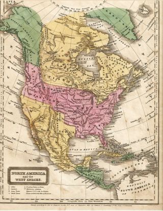
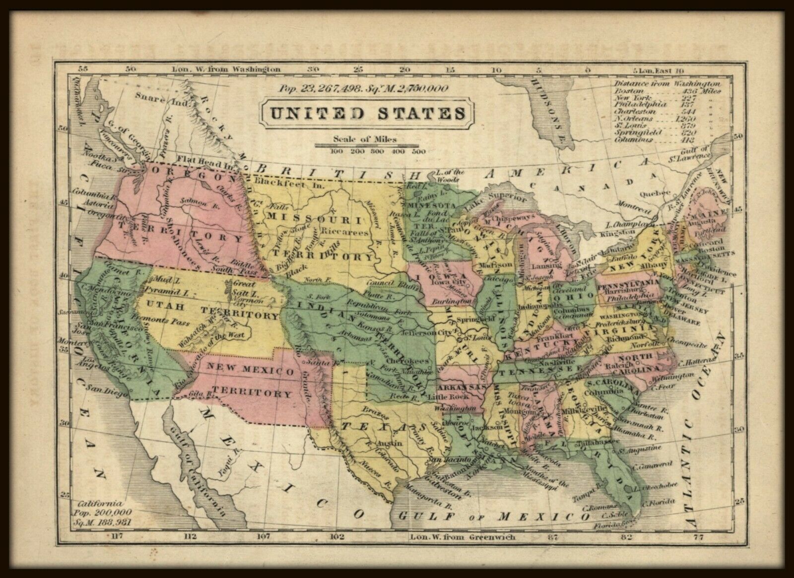
ANTIQUE AMERICAN MAP: UNITED STATES - 1852 - Hand - Colored - 5 X 7 Inches.


Item History & Price

Information:
Reference Number: Avaluer:20123570Year: 1852
Original Description:
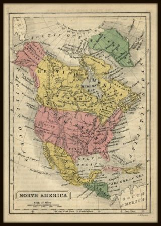
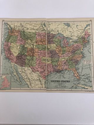
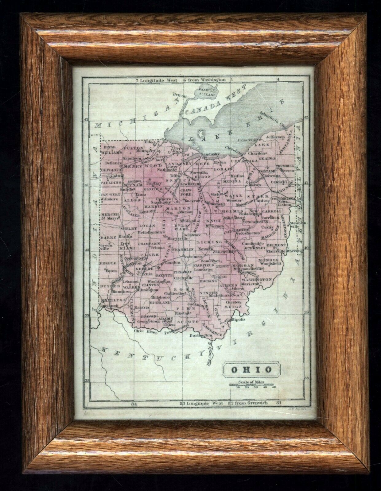
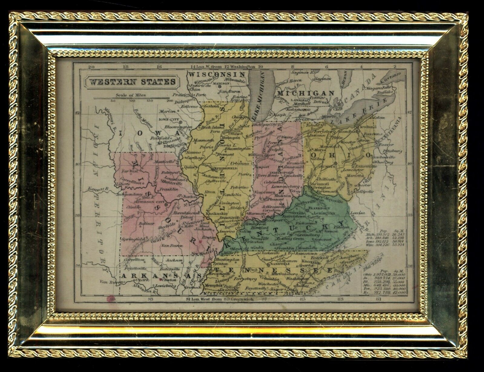
ANTIQUE AMERICAN MAP:  UNITED STATES (as existed in circa 1850)Small size, approximately 5 x 7 inches, including blank margins (perfect for framing, see below), disbound from a child’s1852 textbook: “The First Book of History Combined with Geography” by CharlesA. Goodrich. Map engraving by G. W. Boynton. Light age toning/foxing, blank onverso, may show some ghosting or offset from facing page, now lost. Hand-coloredin pink, yellow and green.May be framed in 5 x 7inch pre-mad...e frames, map can be trimmed a bit to fit proportionally. I have two examples shownin the second and third images of this listing – but this map for sale is unframed.----------------------------------------------------------------------------------Questions welcome. Extra images can be added by request. International shipping available. All orders are carefully packaged for safe delivery. Experienced full time professional bookseller since 1994; print, map and poster seller since 2000. 


    Similar items


  • Antique Early Map United States Mexican Possessions Territories Woodbridge 1821

    Antique Early Map United States Mexican Possessions Territories Woodbridge 1821

  • Rare Antique 1845 Maps United States Exploring Expedition Book Antartica Hawaii

    Rare Antique 1845 Maps United States Exploring Expedition Book Antartica Hawaii

  • Antique American Map: North America - 1852 - Hand - Colored - 5 X 7 Inches.

    Antique American Map: North America - 1852 - Hand - Colored - 5 X 7 Inches.

  • Antique 1930 Map: United States Vintage 90 Years Old Colour Print

    Antique 1930 Map: United States Vintage 90 Years Old Colour Print

  • Vintage 1895 Antique Color Map United States Includes Indian Territory 7.  5 " X 9 "

    Vintage 1895 Antique Color Map United States Includes Indian Territory 7. 5 " X 9 "

  • 1867 Antique Color Map//united States,  Its Territories,  And Parts Of Canada

    1867 Antique Color Map//united States, Its Territories, And Parts Of Canada

  • Antique 1895 Map United States English Colonies North South Virginia

    Antique 1895 Map United States English Colonies North South Virginia

  • Antique 1844 Mitchell’s National Map Of The American Republic United States

    Antique 1844 Mitchell’s National Map Of The American Republic United States


    • You might also like


    • 1860 Mitchell Hand Colored Map Colorado,  Nebraska & Kansas - Civil War Era

      1860 Mitchell Hand Colored Map Colorado, Nebraska & Kansas - Civil War Era

    • 18th Century French Map Of North America

      18th Century French Map Of North America

    • Las Vegas Nevada Vintage 1967 Us Geological Survey Quadrangle Map 4 Panels

      Las Vegas Nevada Vintage 1967 Us Geological Survey Quadrangle Map 4 Panels

    • Vintage 1926 Map Hollywood From The Best Surveys Of The Time

      Vintage 1926 Map Hollywood From The Best Surveys Of The Time

    • American Continent (western Hemisphere) 1747 Bowen Antique Copper Engraved Map

      American Continent (western Hemisphere) 1747 Bowen Antique Copper Engraved Map

    • Gulf Coast Florida Texas United States 1705 De Fer Unusual Antique Engraved Map

      Gulf Coast Florida Texas United States 1705 De Fer Unusual Antique Engraved Map

    • California As Island United States 1700 De Fer Unusual First Edition Antique Map

      California As Island United States 1700 De Fer Unusual First Edition Antique Map

Avaluer          About Us          Privacy Policy          Contact Us          UP
© 2022, avaluer.net, Inc. or its affiliates