AN 1827 CRUCHLEY ' S MAP OF ENGLAND & WALES


Item History & Price

Information:
Reference Number: Avaluer:23755626Cartographer/Publisher: Cruchley's
Year: 1827Original/Reproduction: Antique Original
Date Range: 1800-1899Format: Folding Map
Country/Region: EnglandType: Country Map
Era: 1800s
Original Description:

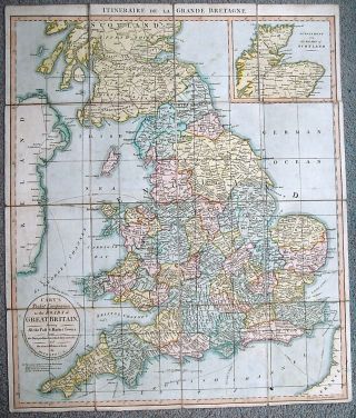
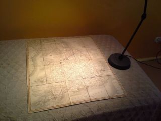
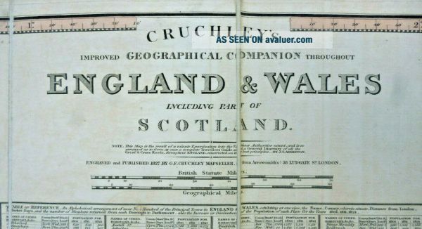
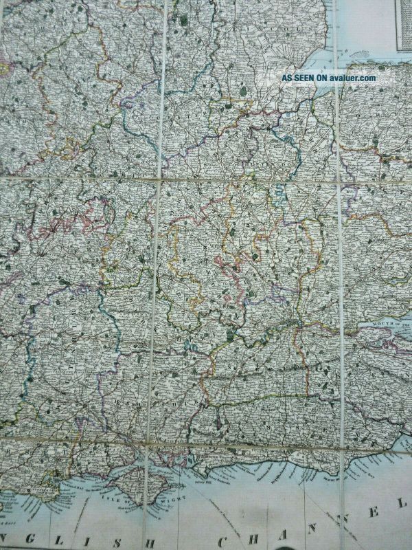
On offer is an original, full-size
Cruchley’sNew and Improved Mapof
England and Wales and Part of Scotland

This large (69 cm x 97 cm), 1827-dated, fold-out linen map showsMail, Turnpike & Travelling Roadsand other information such asGentlemen's Seats, Inns on the Main Roads, Market Days and Remains of Antiquity
It's complete, and in pretty good condition.
There's ageing - mostly at the folds - but not bad after almost 200 years!

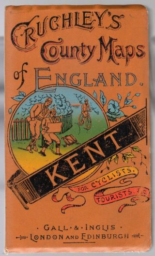
It's in its original ...'sleeve' - which has seen better days!

Please take a look at my other items currently on eBay


    Similar items


  • Gall And Inglis Cruchleys County Maps Of England Sussex Late 1800

    Gall And Inglis Cruchleys County Maps Of England Sussex Late 1800 ' S

  • 1804 Cary

    1804 Cary ' S Map Of England Wales Scotland Great Britain Pocket Companion Roads

  • Vintage Saxton

    Vintage Saxton ' S Map Of England & Wales 1579 Print Framed 21. 50 " X 26. 5 " Antique

  • Cruchley

    Cruchley ' S Map Of Sardinia, The Seat Of War (ie. Northern Italy), 1859, Coloured

  • Vintage Saxton

    Vintage Saxton ' S Map Of England & Wales 1579 Print 1971 British Library Taylowe

  • Cruchleys County Maps Of England (kent) Antique Edwardian C.  1905 Gall & Ingus

    Cruchleys County Maps Of England (kent) Antique Edwardian C. 1905 Gall & Ingus

  • Optimago Hand Cut Wooden Puzzle Christopher Saxton’s Map Of England & Whales

    Optimago Hand Cut Wooden Puzzle Christopher Saxton’s Map Of England & Whales

  • Cary

    Cary ' S. Map Of England 1802


    • You might also like


    • Hungary & Romania 1579 (1584) Ortelius Unusual Antique Copper Engraved Map

      Hungary & Romania 1579 (1584) Ortelius Unusual Antique Copper Engraved Map

    • Brussels Bruxelles Belfium 1777 De Ferraris & Dupuis Large Antique Map Sheet Xxi

      Brussels Bruxelles Belfium 1777 De Ferraris & Dupuis Large Antique Map Sheet Xxi

    • 1616 Atlas Map Of Iceland.

      1616 Atlas Map Of Iceland.

    • Kazan Russia 1767 Le Clerc/lespinasse Antique Copper Engraved City View

      Kazan Russia 1767 Le Clerc/lespinasse Antique Copper Engraved City View

    • 1899 Stanford,  Folding Map Of Norwich,  Norfolk,  Arthur Collins,  Jarrold & Sons,

      1899 Stanford, Folding Map Of Norwich, Norfolk, Arthur Collins, Jarrold & Sons,

    • 1948 Vintage Linen Colour Map Geological Survey Ten Mile Of Great Britain

      1948 Vintage Linen Colour Map Geological Survey Ten Mile Of Great Britain

    • 1944 Map Flying Bombs Sussex Ww2 Newspaper Military Kent Courier German V1 V2

      1944 Map Flying Bombs Sussex Ww2 Newspaper Military Kent Courier German V1 V2

    • Dated 1638 Vellum Map Of Icklesham Sussex Showing Land Uses Owners Etc

      Dated 1638 Vellum Map Of Icklesham Sussex Showing Land Uses Owners Etc

Avaluer          About Us          Privacy Policy          Contact Us          UP
© 2022, avaluer.net, Inc. or its affiliates