CARY ' S. MAP OF ENGLAND 1802
Item History & Price
| Reference Number: Avaluer:25522247 | Cartographer/Publisher: John Cary |
| Country/Region: England | Year: 1802 |
Dear All,
I am selling the following item:
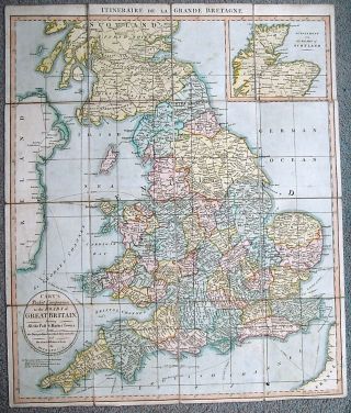
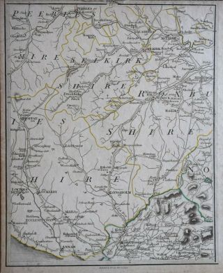
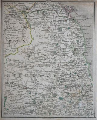
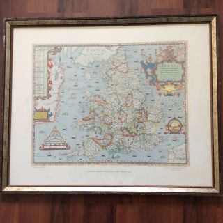
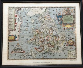
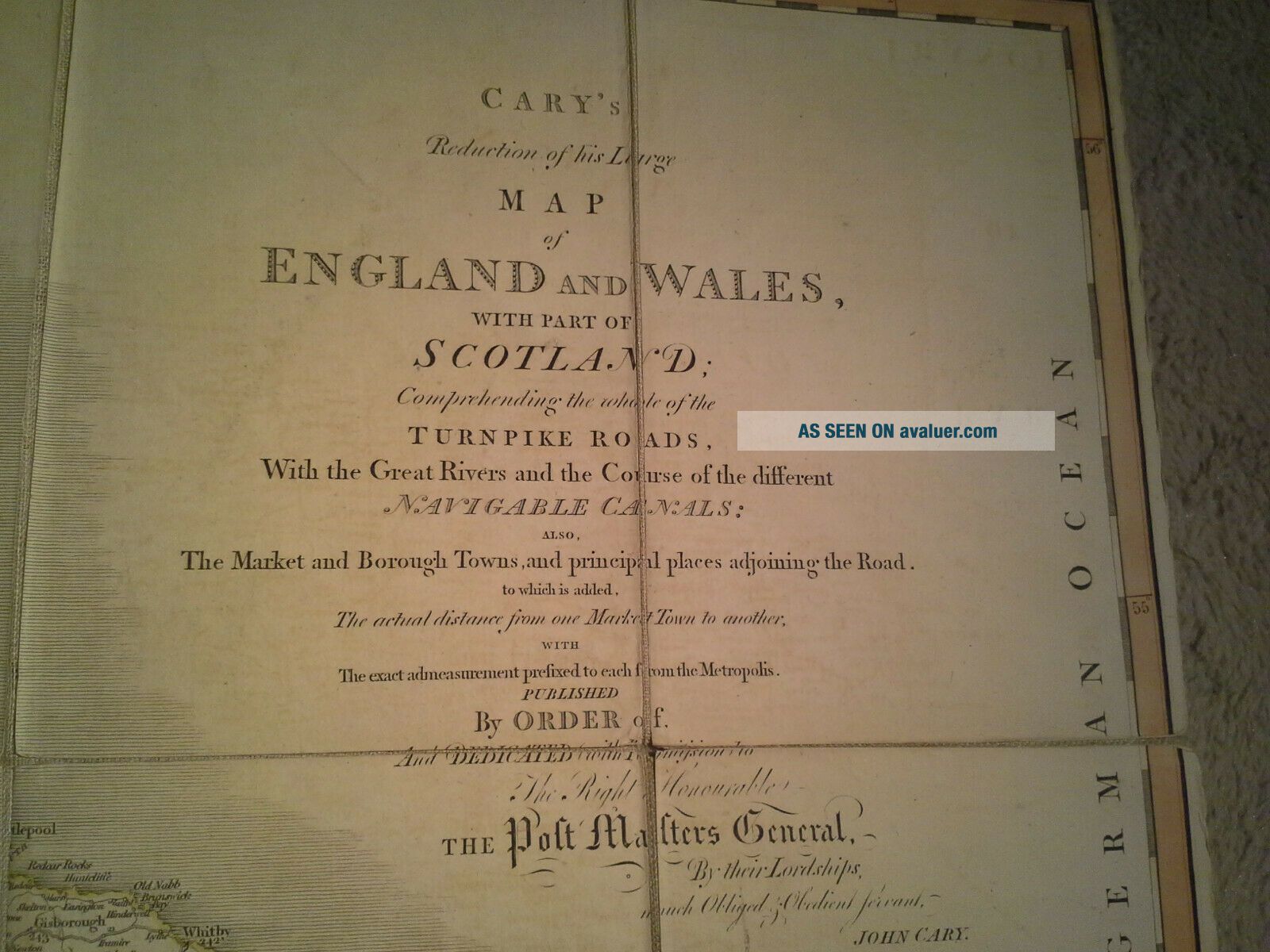
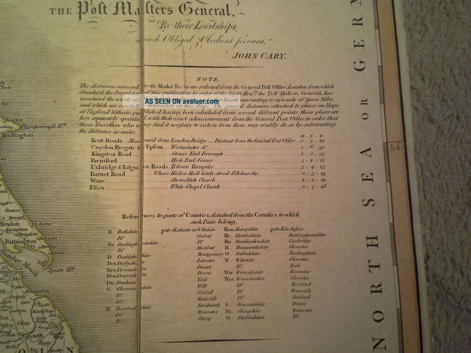
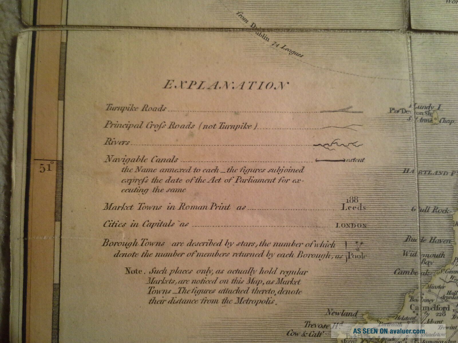
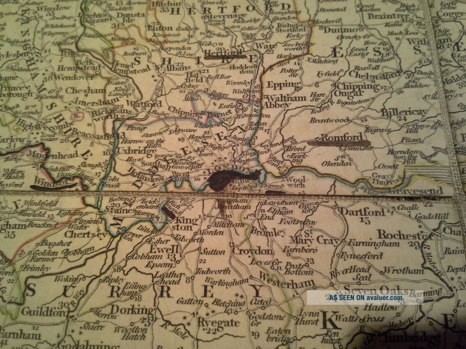
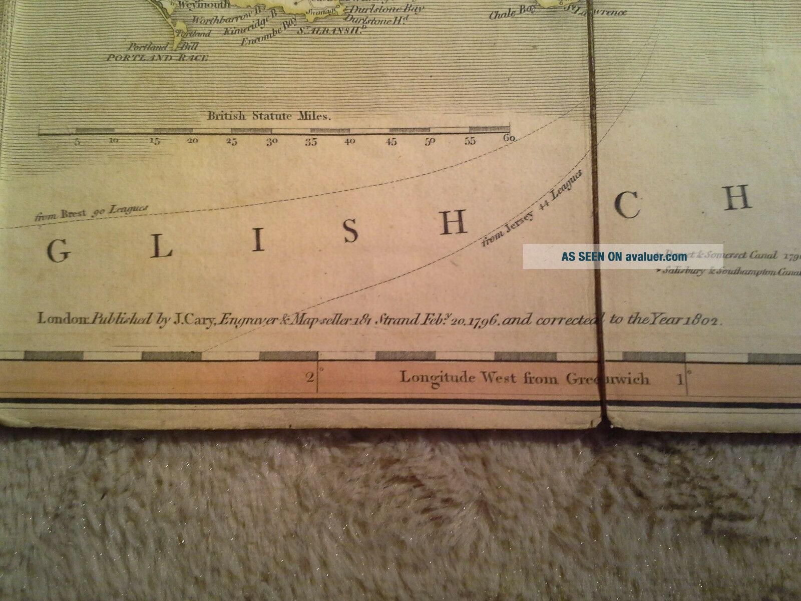
map by famous English cartographer John Cary (ca. 1754–1835):"Cary's Reduction of his Larger Map of England and Wales with Part of Scotland; Comprehending the whole of the Turnpike Roads, With t...he Great Rivers & the Course of the different Navigable Canals: also The Market and Borough Towns, and principal places adjoining the Road. to which is added, The actual distance from one Market Town to another, with The exact admeasurement preficed to each from the Metropolis. Published by Order of, and Dedicated with Permission to The Right Honorable the Post Masters General, by their Lordships, much Obliged & Obedient Servant, John Cary".Based on the date at the bottom, it is dated 1802 (see photos; 1st edition: 1794; officially used until 1840). It is a reduction of Cary's earlier greater/much bigger map of England and Wales. In the presented map, with great care for details, were included elements related with transport matters: roads (differenciated according to rank) and crossroads, channels, distances between cities (differenciated according to rank) etc. It is an image of England and Wales just before the "industrial revolution" - that is why Cary focused on horse and river transport.Size: 76, 5 cm x 63 cm.
"Shipping time: 3 days" means that the shipment will take place maximally after 3-business days counted from the moment of payment.
Customs duties/taxes are not included in the item's price or shipping costs. The Buyer is responsible for settling these fees - usually they are charged by the shipping company when picking up an item = these are not additional shipping costs. I do not understate the custom value of shipment.
Several purchased items can be send in one package - just write me on shipments' cost calculation.
Want to negotiate the cost of delivery? Send me the name of your country and I will see what I can do.
If You have questions, feel invited to contact me.
I kindly encourage You to view my other items.
I am selling the following item:
map by famous English cartographer John Cary (ca. 1754–1835):"Cary's Reduction of his Larger Map of England and Wales with Part of Scotland; Comprehending the whole of the Turnpike Roads, With t...he Great Rivers & the Course of the different Navigable Canals: also The Market and Borough Towns, and principal places adjoining the Road. to which is added, The actual distance from one Market Town to another, with The exact admeasurement preficed to each from the Metropolis. Published by Order of, and Dedicated with Permission to The Right Honorable the Post Masters General, by their Lordships, much Obliged & Obedient Servant, John Cary".Based on the date at the bottom, it is dated 1802 (see photos; 1st edition: 1794; officially used until 1840). It is a reduction of Cary's earlier greater/much bigger map of England and Wales. In the presented map, with great care for details, were included elements related with transport matters: roads (differenciated according to rank) and crossroads, channels, distances between cities (differenciated according to rank) etc. It is an image of England and Wales just before the "industrial revolution" - that is why Cary focused on horse and river transport.Size: 76, 5 cm x 63 cm.
"Shipping time: 3 days" means that the shipment will take place maximally after 3-business days counted from the moment of payment.
Customs duties/taxes are not included in the item's price or shipping costs. The Buyer is responsible for settling these fees - usually they are charged by the shipping company when picking up an item = these are not additional shipping costs. I do not understate the custom value of shipment.
Several purchased items can be send in one package - just write me on shipments' cost calculation.
Want to negotiate the cost of delivery? Send me the name of your country and I will see what I can do.
If You have questions, feel invited to contact me.
I kindly encourage You to view my other items.