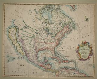
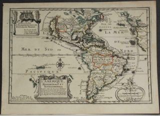
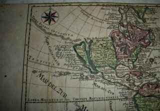
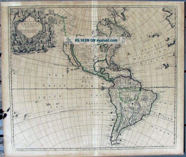
California As An Island, English Map, 1719, John Senex
Item History & Price
| Reference Number: Avaluer:27421447 | Cartographer/Publisher: John Senex |
| US State: California | Year: 1719 |
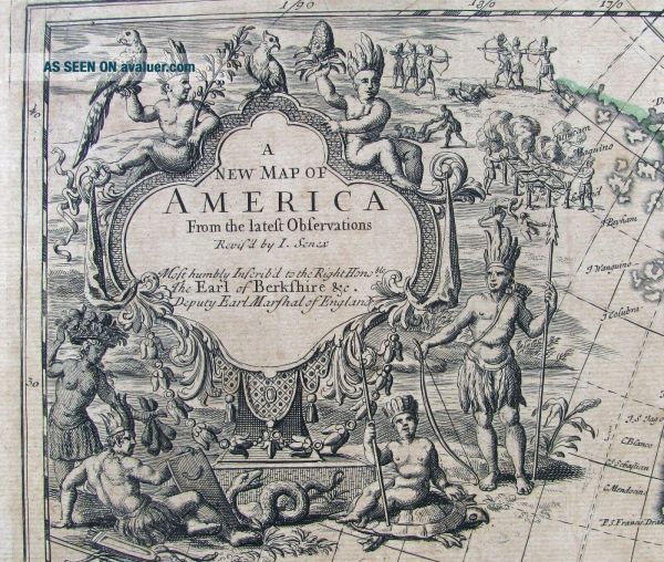
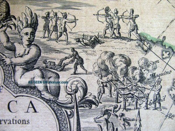
This auction is for an early English map by John Senex (1678-1740) titled "A New Map of America" showing the western hemisphere as it was understood in 1719 when the map was published. This famously shows California as an island and has a few of the iconic seventeenth century images of American Indians. John Senex (1678-1740) was one of the foremost mapmakers in England in the early eighteenth century. He was also a surveyor, globemaker, and geographer. As a young man, he was appr...enticed to Robert Clavell, a bookseller. He worked with several mapmakers over the course of his career, including Jeremiah Seller and Charles Price. In 1728, Senex was elected as a Fellow of the Royal Society, a rarity for mapmakers. The Fellowship reflects his career-long association as engraver to the Society and publisher of maps by Edmund Halley, among other luminaries. He is best known for his English Atlas (1714), which remained in print until the 1760s. After his death in 1740 his widow, Mary, carried on the business until 1755. Thereafter, his stock was acquired by William Herbert and Robert Sayer (maps) and James Ferguson (globes).I believe this to be an original print but has been laid down on a piece of thin, stiff cardboard. It has darkened over time except for the crease in the middle where it was bound in an atlas. This measures 24 3/8" x 20 3/4" and has never been colored. The images in the upper right corner show a variety of real and imagined animals and Indians. Parrots, snakes, tobacco leaves, pineapple and a giant tortoise surround the title. There are also some rather gruesome depictions of Indians in warfare with bows and arrows and grilling human body parts. The map appears to be intact with no tears or missing parts. I don't know if it can be lifted off the cardboard but is probably worth the effort. NO RESERVE.All items are guaranteed as to age, authenticity and condition. Most pieces are shipped USPS priority mail with delivery confirmation. Large or delicate pieces will need to be sent by a third party at buyers expense. I use a local shipper who is reliable, efficient and reasonable. Additional photos provided when requested. I do accept returns for items not as described.