1867 US Coast Survey General Chart Map Cape Henry, Virginia To Cape Lookout, NC


Item History & Price

Information:
Reference Number: Avaluer:58934988Cartographer/Publisher: A.D. Bache
Year: 1867Printing Technique: Lithography
US State: Delaware, Maryland, North Carolina, VirginiaOriginal/Reproduction: Antique Original
Date Range: 1800-1899Format: Folding Map
City: RichmondType: Nautical Map
Country/Region: United States of America
Original Description:
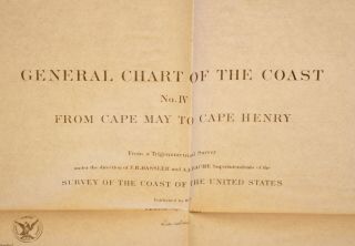
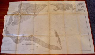
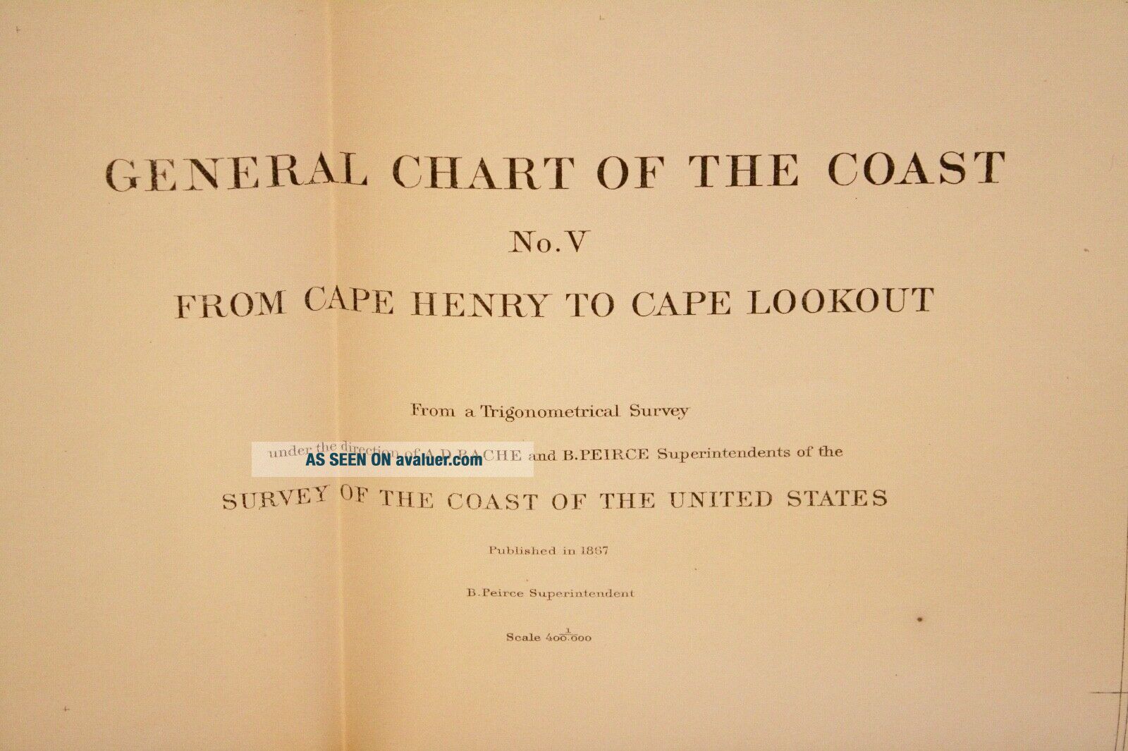
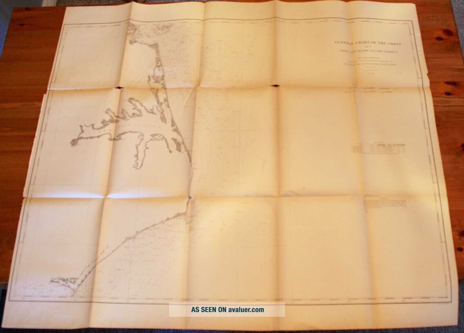
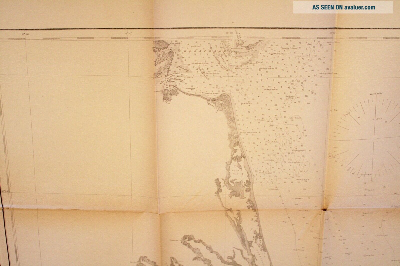
US Coast Survey General Chart of the Coast No. V, Map No. 14 From Cape Henry, Virginia to Cape Lookout, North CarolinaFrom a Trigonometrical Survey under the direction of A.D. Bache and Benjamin Peirce SuperintendentsPublished 1867
The map covers the Atlantic coastline from Virginia to North CarolinaIncludes indexes of Light Houses and Soundings
Fragile condition with numerous holes and tears, and discoloration along folds37-½" x 33"
Item #MCS-74
Shipping is standard ...post (no tracking) for Canada and US. Express, tracking, and international shipping by quote. If purchasing multiple items to be shipped together, a refund of additional shipping will be issued upon mailing based on the actual cost.


    Similar items


  • 1862 Us Coast Survey General Chart Map Cape May,  Nj To Cape Henry,  Virginia

    1862 Us Coast Survey General Chart Map Cape May, Nj To Cape Henry, Virginia

  • Preliminary Chart Of Hudson River York Map Us Coast Survey 1861

    Preliminary Chart Of Hudson River York Map Us Coast Survey 1861

  • 1856 Us Coast Survey Large Antique Map,  Chart Charleston Harbor,  South Carolina

    1856 Us Coast Survey Large Antique Map, Chart Charleston Harbor, South Carolina

  • 1851 Map Superintendent Of Us Coast Survey Frying Pan Shoals Cape Fear

    1851 Map Superintendent Of Us Coast Survey Frying Pan Shoals Cape Fear

  • 1867 Us Coast Survey Map Of Puget Sound,  Washington Territory

    1867 Us Coast Survey Map Of Puget Sound, Washington Territory

  • 1867 Us Coast Survey Map York Entrance Incl Staten Island

    1867 Us Coast Survey Map York Entrance Incl Staten Island

  • 1867 Us Coast Survey Map Of Shilshole Bay,  Puget Sound,  Washington Territory

    1867 Us Coast Survey Map Of Shilshole Bay, Puget Sound, Washington Territory

  • 1867 Us Coast Survey Map Pamlico Sound,  Outer Banks,  North Carolina

    1867 Us Coast Survey Map Pamlico Sound, Outer Banks, North Carolina


    • You might also like


    • 1860 Mitchell Hand Colored Map Colorado,  Nebraska & Kansas - Civil War Era

      1860 Mitchell Hand Colored Map Colorado, Nebraska & Kansas - Civil War Era

    • 18th Century French Map Of North America

      18th Century French Map Of North America

    • Las Vegas Nevada Vintage 1967 Us Geological Survey Quadrangle Map 4 Panels

      Las Vegas Nevada Vintage 1967 Us Geological Survey Quadrangle Map 4 Panels

    • Rare Antique 1845 Maps United States Exploring Expedition Book Antartica Hawaii

      Rare Antique 1845 Maps United States Exploring Expedition Book Antartica Hawaii

    • Vintage 1926 Map Hollywood From The Best Surveys Of The Time

      Vintage 1926 Map Hollywood From The Best Surveys Of The Time

    • American Continent (western Hemisphere) 1747 Bowen Antique Copper Engraved Map

      American Continent (western Hemisphere) 1747 Bowen Antique Copper Engraved Map

    • Gulf Coast Florida Texas United States 1705 De Fer Unusual Antique Engraved Map

      Gulf Coast Florida Texas United States 1705 De Fer Unusual Antique Engraved Map

    • California As Island United States 1700 De Fer Unusual First Edition Antique Map

      California As Island United States 1700 De Fer Unusual First Edition Antique Map

Avaluer          About Us          Privacy Policy          Contact Us          UP
© 2022, avaluer.net, Inc. or its affiliates