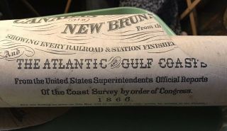
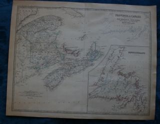
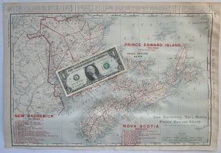
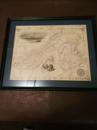
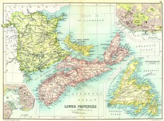
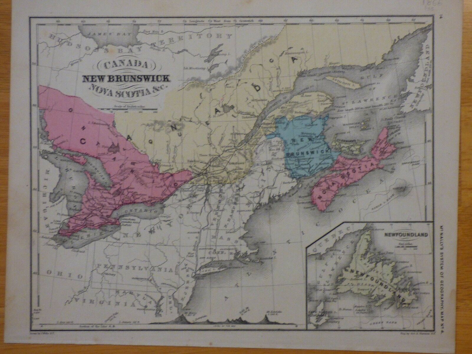
1866 Map Of E. Canada Brunswick Nova Scotia From McNally ' S School Geography


Item History & Price

Information:
Reference Number: Avaluer:14284687Topic: Maps
Year: 1866Publication Year: 1866
Country/Region: CanadaCanadian Province: New Brunswick, Nova Scotia
Subject: GeographyFormat: School Map
Original Description:
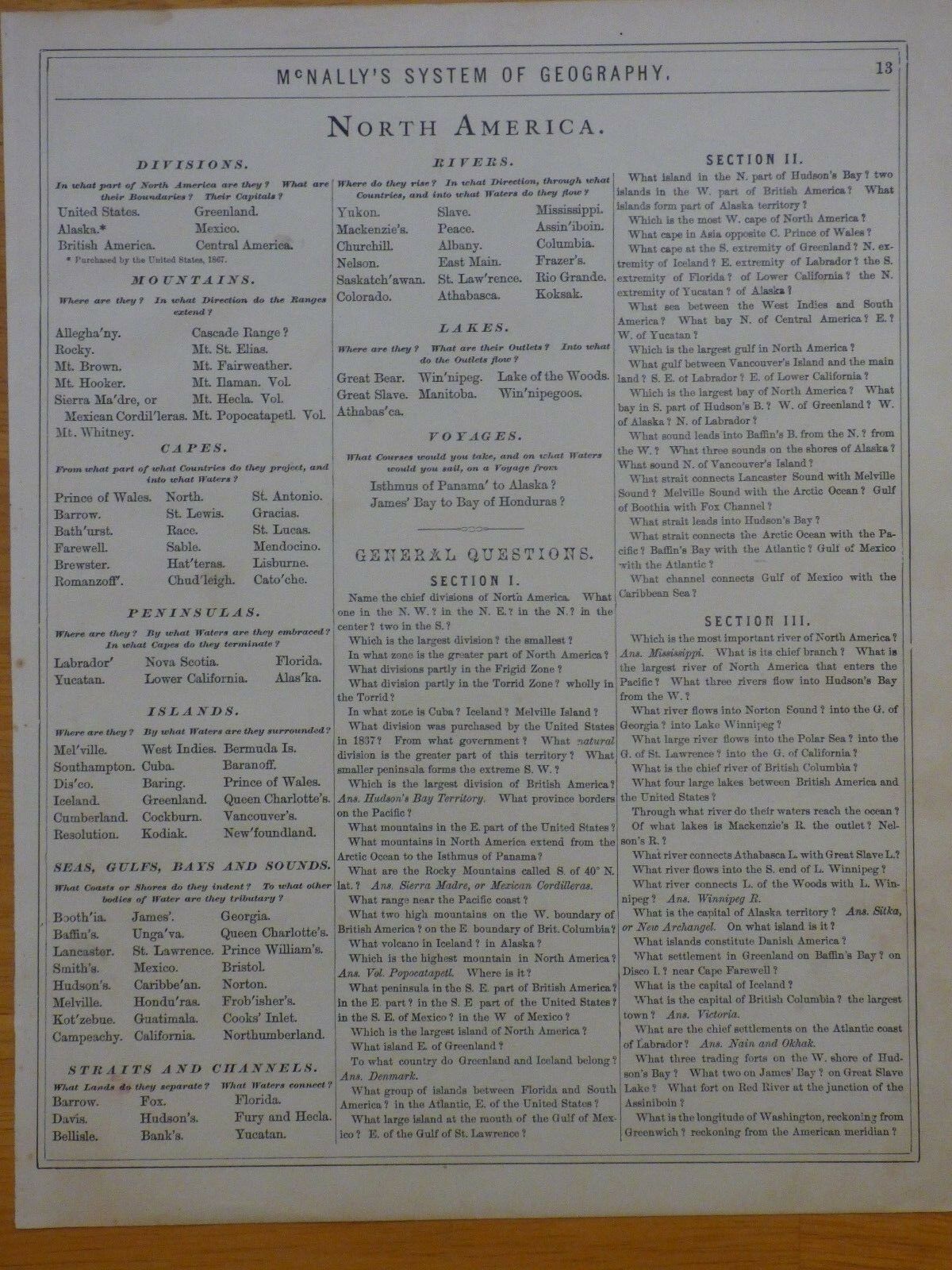
This is an 1866 map of eastern Canada, New Brunswick, and Nova Scotia (and an inset of Newfoundland) from McNally's System of Geography book. On the reverse  is information on North America geographical features and questions. See above for condition. Measures about 9.5 x 12 inches.


    Similar items


  • 1866 Wall Map United States Canada Brunswick - Ships Chunks Graphics

    1866 Wall Map United States Canada Brunswick - Ships Chunks Graphics

  • Large Antique Map Of Eastern Canada N.  B. ,  P.  E.  I,  N.  S.  Nfld.  Published 1861

    Large Antique Map Of Eastern Canada N. B. , P. E. I, N. S. Nfld. Published 1861

  • Lg 1901 Canada Brunswick,  Nova Scotia,  Prince Edward Island Railroad Map

    Lg 1901 Canada Brunswick, Nova Scotia, Prince Edward Island Railroad Map

  • Antique Map Of East Canada And Brunswick (framed) 16 3/4 Wide × 13 3/4 " High

    Antique Map Of East Canada And Brunswick (framed) 16 3/4 Wide × 13 3/4 " High

  • Canada.  Brunswick Nova Scotia; St John; Halifax; Newfoundland 1909 Old Map

    Canada. Brunswick Nova Scotia; St John; Halifax; Newfoundland 1909 Old Map

  • Map Of Cape Breton Island Nova Scotia Canada Vintage Postcard

    Map Of Cape Breton Island Nova Scotia Canada Vintage Postcard

  • Antique Tallis Map Of " East Canada " (quebec & Brunswick) 1851 Hand - Colored

    Antique Tallis Map Of " East Canada " (quebec & Brunswick) 1851 Hand - Colored

  • Antique 1877 Edition Johnson’s 1866 Map Of The State Of Texas

    Antique 1877 Edition Johnson’s 1866 Map Of The State Of Texas


    • You might also like


    • 1860 Mitchell Hand Colored Map Colorado,  Nebraska & Kansas - Civil War Era

      1860 Mitchell Hand Colored Map Colorado, Nebraska & Kansas - Civil War Era

    • 18th Century French Map Of North America

      18th Century French Map Of North America

    • Las Vegas Nevada Vintage 1967 Us Geological Survey Quadrangle Map 4 Panels

      Las Vegas Nevada Vintage 1967 Us Geological Survey Quadrangle Map 4 Panels

    • Rare Antique 1845 Maps United States Exploring Expedition Book Antartica Hawaii

      Rare Antique 1845 Maps United States Exploring Expedition Book Antartica Hawaii

    • Vintage 1926 Map Hollywood From The Best Surveys Of The Time

      Vintage 1926 Map Hollywood From The Best Surveys Of The Time

    • American Continent (western Hemisphere) 1747 Bowen Antique Copper Engraved Map

      American Continent (western Hemisphere) 1747 Bowen Antique Copper Engraved Map

    • Gulf Coast Florida Texas United States 1705 De Fer Unusual Antique Engraved Map

      Gulf Coast Florida Texas United States 1705 De Fer Unusual Antique Engraved Map

    • California As Island United States 1700 De Fer Unusual First Edition Antique Map

      California As Island United States 1700 De Fer Unusual First Edition Antique Map

Avaluer          About Us          Privacy Policy          Contact Us          UP
© 2022, avaluer.net, Inc. or its affiliates