AMERICA 1710 JB HOMANN CALIFORNIA AS AN ISLAND UNUSUAL LARGE ANTIQUE MAP


Item History & Price

Information:
Reference Number: Avaluer:44566938Cartographer/Publisher: Johann Baptist Homann
Year: 1710Printing Technique: Copper Plate
US State: CaliforniaOriginal/Reproduction: Antique Original
Date Range: 1700-1799
Original Description:

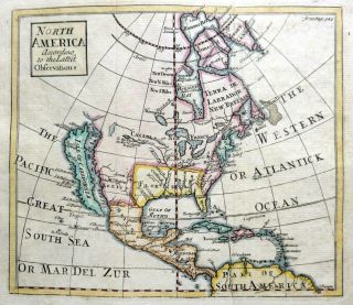
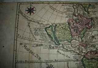
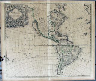
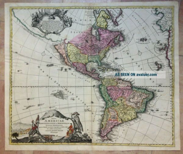
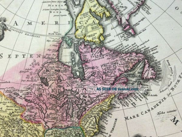
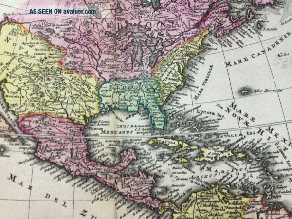
Title of the map:"Totius AMERICAE Septentrionalis et Meridionalis Novissima repraesentatio ....IOHANNES BAPTISTA HOMANN...Norimbergae ..."
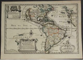
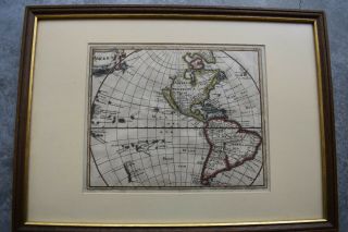
Large and unusual antique copper engraved Map of the American Continent, by Johann Baptist HOMANN (1664-1724). 
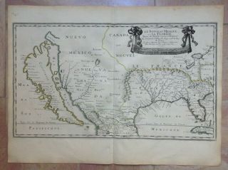
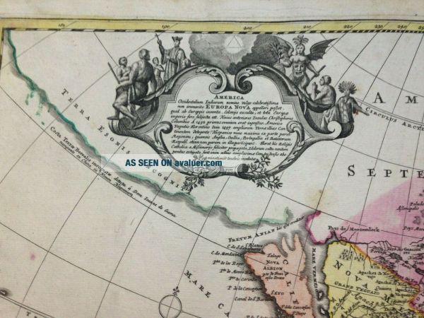
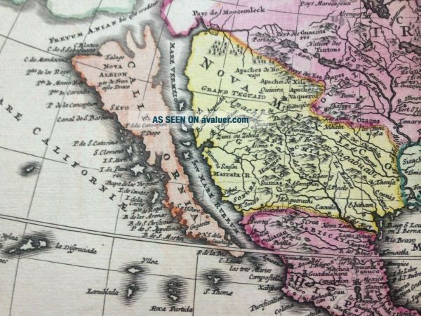
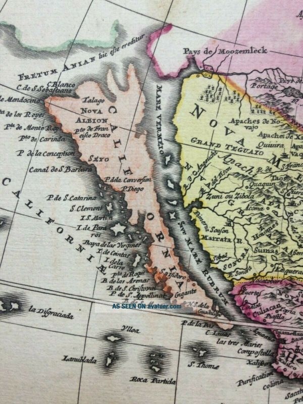
This map shows California as an island after the Sanson model but with the addition of the towns of Isidoro, Gigante and N S de la Guadelupe inserted in the south of the island. The Strait of Anian is forming a nor...thwest passage between California and the mythical Terra Esonis, which forms a nearly land bridge from the northwest to Asia. The "Pays de Moozemleck" is shown at the east of the Strait of Anian. The Great lakes are shown with some details.The large title cartouche is copied from De Fer's map of 1699 and the cartouche top left containing descriptive text is in part copied from the design used in De Lisle map of Canada of 1703.  The map is very detailed, with indian villages.

Johann Baptist Homann was the most prolific map publisher of the 18th Century. He founded his company in 1702. In 1705, he became the Geograph of the Emperor Charles VI. In the same year, he was also Member of the Prussian Academy of Sciences in Berlin. They protected the authors in all scientific fields such as printers, copper engravers, map makers and publishers. In 1716 Homann published his "Grosser Atlas ueber die ganze Welt" (Grand Atlas of all the World). Some maps were drawned with the engraver Christoph Weigel the Elder. Homann died in Nuremberg. He was succeded by the Homann heirs company, which was in business until 1848. 

Size with margins : 52 x 60, 5 cm / 20, 4 x 23, 6 inches
Condition : very good condition,  original colors, well engraved, on strong paper.Edition : Nuremberg, 1710, XVIIIe Century.

If you buy more than one item, you have to pay only one shipping cost.All shipments are insured.
WE DON'T SELL LASER AND COPIES MAPS, ALL WE SELL IS ORIGINAL AND ANTIQUEDue to the age an type of paper, some imperfections are to be expected. Please examine the images provided carefully, and if you have any questions please ask and we will be happy to help you


    Similar items


  • North America California As An Island By John Senex C1740 Antique Map

    North America California As An Island By John Senex C1740 Antique Map

  • American Continent California As An Island 1700 De Fer Unusual Antique Map

    American Continent California As An Island 1700 De Fer Unusual Antique Map

  • 1697 Philip Cluver Map America California As An Island Coloring

    1697 Philip Cluver Map America California As An Island Coloring

  • 1683 Mallet Map Of The World In Armillary Spheres - California As An Island - Rare

    1683 Mallet Map Of The World In Armillary Spheres - California As An Island - Rare

  • Antique 1749 Johann Schreiber Map Of America W/ California As An Island Vafo

    Antique 1749 Johann Schreiber Map Of America W/ California As An Island Vafo

  • California As An Island,  English Map,  1719,  John Senex

    California As An Island, English Map, 1719, John Senex

  • America California As An Island 1656 Nicolas Sanson Very Rare Large Antique Map

    America California As An Island 1656 Nicolas Sanson Very Rare Large Antique Map

  • 1747 The Preceptor Vol Ii London Maps Of California As An Island Edmund Bowen

    1747 The Preceptor Vol Ii London Maps Of California As An Island Edmund Bowen


    • You might also like


    • 1860 Mitchell Hand Colored Map Colorado,  Nebraska & Kansas - Civil War Era

      1860 Mitchell Hand Colored Map Colorado, Nebraska & Kansas - Civil War Era

    • 18th Century French Map Of North America

      18th Century French Map Of North America

    • Las Vegas Nevada Vintage 1967 Us Geological Survey Quadrangle Map 4 Panels

      Las Vegas Nevada Vintage 1967 Us Geological Survey Quadrangle Map 4 Panels

    • Rare Antique 1845 Maps United States Exploring Expedition Book Antartica Hawaii

      Rare Antique 1845 Maps United States Exploring Expedition Book Antartica Hawaii

    • Vintage 1926 Map Hollywood From The Best Surveys Of The Time

      Vintage 1926 Map Hollywood From The Best Surveys Of The Time

    • American Continent (western Hemisphere) 1747 Bowen Antique Copper Engraved Map

      American Continent (western Hemisphere) 1747 Bowen Antique Copper Engraved Map

    • Gulf Coast Florida Texas United States 1705 De Fer Unusual Antique Engraved Map

      Gulf Coast Florida Texas United States 1705 De Fer Unusual Antique Engraved Map

    • California As Island United States 1700 De Fer Unusual First Edition Antique Map

      California As Island United States 1700 De Fer Unusual First Edition Antique Map

Avaluer          About Us          Privacy Policy          Contact Us          UP
© 2022, avaluer.net, Inc. or its affiliates